Category:National Road
Jump to navigation
Jump to search
road in the United States | |||||
| Upload media | |||||
| Instance of | |||||
|---|---|---|---|---|---|
| Location |
| ||||
| Heritage designation | |||||
| Inception |
| ||||
 | |||||
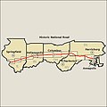
- English: The National Road (also known as the Cumberland Road and National Pike) was the first major improved highway in the United States built by the federal government. The 620-mile (1,000 km) road was built between 1811 and 1837, from Cumberland, Maryland to Vandalia, Illinois. Today, much of the road's alignment is followed by U.S. Route 40.
Beyond the National Road's eastern terminus at Cumberland and toward the Atlantic coast, a series of private toll roads and turnpikes were constructed, connecting the National Road (also known as the Old National Pike) with Baltimore. Completed in 1824, these feeder routes formed what is referred to as an eastern extension of the federal National Road.
Subcategories
This category has the following 16 subcategories, out of 16 total.
B
- Brownsville Bridge (16 F)
C
- Casselman River Bridge (74 F)
D
- Dunlap's Creek Bridge (23 F)
E
H
- History of the National Road (11 F)
L
- La Vale Tollgate House (30 F)
M
N
- National Road (Maryland) (14 F)
S
W
Media in category "National Road"
The following 66 files are in this category, out of 66 total.
-
National road map.png 600 × 353; 73 KB
-
1840THE NATIONAL PIKE (15781147284).jpg 2,877 × 2,153; 569 KB
-
Cumberland Narrows air.jpg 850 × 520; 151 KB
-
Cumberland Road (National Road) in Illinois and Indiana.jpg 1,462 × 459; 221 KB
-
Cumberland-national-road-marker-riverside-park2012.jpg 750 × 1,000; 530 KB
-
Four Mile House at La Vale.jpg 6,016 × 4,000; 7.01 MB
-
Geography of Ohio - DPLA - aaba7b3295ff6973b6fd1e23e33cde14 (page 116) (cropped).jpg 1,843 × 1,918; 599 KB
-
GreenupIL.jpg 3,330 × 2,241; 1.29 MB
-
Henry Clay Township tavern.jpg 6,016 × 4,000; 6.92 MB
-
Historic highways of America (Volume 10) - Frontispiece.png 1,841 × 1,235; 1,014 KB
-
Historic highways of America (Volume 10) - III.png 1,809 × 1,227; 1.09 MB
-
Historic National Road - A Stone Arch - NARA - 7719350.jpg 2,668 × 1,748; 1.43 MB
-
Historic National Road - A Stone Arch Bridge West of Marshall - NARA - 7719384.jpg 2,977 × 2,022; 5.46 MB
-
Historic National Road - Along US-40 - NARA - 7719290.jpg 1,280 × 800; 254 KB
-
Historic National Road - Antique Cars on Display - NARA - 7719299.jpg 1,280 × 960; 176 KB
-
Historic National Road - Archer House, the Oldest Hotel in Illinois - NARA - 7719373.jpg 3,572 × 2,371; 7.11 MB
-
Historic National Road - Cahokia Mounds Historical Site - NARA - 7719382.jpg 3,440 × 2,449; 7.72 MB
-
Historic National Road - Livingston Spur - NARA - 7719347.jpg 1,748 × 2,668; 1.72 MB
-
Historic National Road - Original Brick Section of Rt. 40 - NARA - 7719348.jpg 2,429 × 3,277; 1.64 MB
-
Historic National Road - Richard W. Bock Museum - NARA - 7719349.jpg 2,576 × 1,648; 1,017 KB
-
Historic National Road - Swiss Architecture in Highland - NARA - 7719380.jpg 3,310 × 2,407; 5.48 MB
-
Historic National Road - Windmill Tail - NARA - 7719400.jpg 280 × 210; 21 KB
-
Hopewell Township hall, Mount Sterling.jpg 6,016 × 4,000; 6.28 MB
-
Lover's Leap, Cumberland Narrows, MD.jpg 460 × 750; 130 KB
-
Madonna of the Trail (Vandalia, Illinois).jpg 3,024 × 4,032; 5.71 MB
-
Madonna-of-the-Trail-Illino.jpg 410 × 610; 31 KB
-
Mount Sterling UMC, Muskingum County.jpg 6,016 × 4,000; 6.36 MB
-
Mount Washington Tavern Bedroom (134da522-5404-4458-80d5-5572476ce234).jpg 3,264 × 1,472; 951 KB
-
Mount Washington Tavern Bedroom (a288e270-c936-4163-a37c-802105d0ca43).jpg 2,388 × 1,472; 302 KB
-
Mount Washington Tavern Dining Room (7c925262-6354-47c3-9f0e-05d1f53d7b3e).jpg 2,900 × 1,308; 336 KB
-
Mount Washington Tavern in Winter (84ea2dc0-1dd8-b71b-0b60-af7a90f8fa2f).jpg 3,072 × 4,608; 3.19 MB
-
Mount Washington Tavern's Bar Room (bdf1de7e-8255-4219-8e81-15d0d3859cdc).jpg 2,897 × 1,306; 370 KB
-
National Pike just east of Brownsville.jpg 6,016 × 4,000; 6.42 MB
-
National Road bridge site near Clark Center.jpg 6,016 × 4,000; 6.38 MB
-
National Road east of Clark Center.jpg 2,112 × 2,816; 3.19 MB
-
National Road Marker Richmond.jpg 3,456 × 5,184; 5.73 MB
-
National Road, 1822 map.jpg 2,212 × 1,209; 334 KB
-
Old National Road, Clark Center, IL, US.jpg 4,000 × 6,000; 34.9 MB
-
Old Stone Arch at Marshall.jpg 2,816 × 1,584; 3.03 MB
-
Old Stone Arch Bridge, National Road, Marshall, IL, US.jpg 6,000 × 2,376; 12.35 MB
-
Red Brick Tavern in Lafayette.jpg 2,816 × 2,112; 2.5 MB
-
Tavener-Sears Tavern site.jpg 6,016 × 4,000; 6.32 MB
-
View from the Cumberland Road near Georgetown LCCN2016652473.jpg 9,511 × 3,048; 3.97 MB
-
View from the Cumberland Road near Georgetown LCCN2016652473.tif 9,511 × 3,048; 83 MB
-
Zane's Trace.png 795 × 605; 332 KB
Categories:
- Roads in the United States
- National Scenic Byways in Illinois
- National Historic Civil Engineering Landmarks
- National Historic Civil Engineering Landmarks in Maryland
- National Historic Civil Engineering Landmarks in Pennsylvania
- National Historic Civil Engineering Landmarks in West Virginia
- National Historic Civil Engineering Landmarks in Ohio
- National Historic Civil Engineering Landmarks in Indiana
- National Historic Civil Engineering Landmarks in Illinois
- All-American Roads
- National Scenic Byways in Maryland
- National Scenic Byways in West Virginia
- National Scenic Byways in Ohio
- U.S. Route 40
- Scenic byways in the United States


