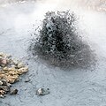
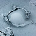
Category:Námafjall - Mudpots
Jump to navigation
Jump to search
Subcategories
This category has the following 4 subcategories, out of 4 total.
G
H
M
Media in category "Námafjall - Mudpots"
The following 47 files are in this category, out of 47 total.
-
2008-05-21 11 04 53 Iceland-Reykjahlíð.jpg 2,048 × 1,536; 2.82 MB
-
2014-05-03 16-15-13 Iceland - Mývatni Reykjahlíð.jpg 4,278 × 2,788; 9.68 MB
-
2014-05-03 16-19-09 Iceland - Mývatni Reykjahlíð 5h 232°.JPG 12,973 × 2,526; 18.44 MB
-
2014-05-03 16-21-31 Iceland - Mývatni Reykjahlíð 8h 335°.JPG 18,915 × 2,617; 25.52 MB
-
2022-05-20 13-30-38 Námafjall - Mudpots.jpg 6,192 × 4,128; 16.73 MB
-
63 Namaskard-Hverir (8).JPG 4,000 × 3,000; 2.37 MB
-
Bjarnarflag 02.JPG 2,592 × 1,944; 951 KB
-
Bjarnarflag 03.JPG 2,592 × 1,944; 849 KB
-
Geothermical site - panoramio (3).jpg 3,648 × 2,432; 18.03 MB
-
Geothermical site - panoramio (4).jpg 2,432 × 3,648; 14.52 MB
-
HotSpringNamaskardh.jpg 2,980 × 1,991; 1.01 MB
-
Hverarönd - panoramio (3).jpg 1,600 × 1,200; 478 KB
-
Hverir Geothermal Area - 2013.08 - panoramio.jpg 4,608 × 3,456; 3.22 MB
-
Hverir geysirs.jpg 5,184 × 3,456; 6.95 MB
-
Iceland (19408459644).jpg 3,264 × 2,448; 1.45 MB
-
Iceland (19408693614).jpg 2,448 × 3,264; 2.62 MB
-
Iceland Hverir at Mývatn (with people).jpg 2,272 × 1,704; 778 KB
-
IS-myvatn-solfat-01.jpg 4,928 × 3,264; 5.36 MB
-
IS-myvatn-solfat-03.jpg 4,928 × 3,264; 3.9 MB
-
Island1984 120.jpg 3,208 × 2,090; 1.38 MB
-
Islande Námafjall vue générale.jpg 1,536 × 1,024; 500 KB
-
Myvatn-07.jpg 978 × 732; 169 KB
-
Namafell32.JPG 2,304 × 3,072; 3.72 MB
-
Namafjall - Kochender Schlamm 1.jpg 2,560 × 1,920; 1.42 MB
-
Namafjall - Kochender Schlamm 2.jpg 2,560 × 1,920; 1.61 MB
-
Namafjall - Kochender Schlamm 4.jpg 2,560 × 1,920; 1.56 MB
-
Namafjall - Schlammkrater 1.jpg 2,560 × 1,920; 1.16 MB
-
Namafjall - Schlammkrater 2.jpg 2,560 × 1,920; 1.54 MB
-
Namafjall 06 (1418180352).jpg 2,048 × 1,536; 524 KB
-
Namafjall area - hot springs - Iceland - panoramio.jpg 3,648 × 2,736; 4.34 MB
-
Namafjall near Myvatn Iceland 1.JPG 2,592 × 1,944; 1.41 MB
-
Namafjall near Myvatn Iceland 2.JPG 2,592 × 1,944; 1.04 MB
-
Námafjall Iceland 003.JPG 1,200 × 900; 260 KB
-
Námafjall Iceland 004.JPG 1,200 × 900; 171 KB
-
Námafjall Iceland 005.JPG 1,200 × 900; 174 KB
-
Námafjall Iceland 028.JPG 1,200 × 900; 186 KB
-
Námafjall Iceland 033.JPG 1,200 × 900; 309 KB
-
Námafjall Iceland 035.JPG 1,200 × 900; 251 KB
-
Námafjall mudpots (1).jpg 3,872 × 2,592; 2.33 MB
-
Námafjall mudpots (3).jpg 3,872 × 2,592; 2.32 MB
-
Námafjall mudpots (6).jpg 3,872 × 2,592; 2.42 MB
-
Námaskarð (3795450829).jpg 4,272 × 2,840; 5.02 MB
-
Schlammtopf im Feld Námafjall Hverir 6010.JPG 2,573 × 2,573; 3.28 MB
-
Schlammtopf im Feld Námafjall Hverir 6021.JPG 2,525 × 2,525; 3.51 MB
-
Schlammtopf im Feld Námafjall Hverir 6024.JPG 2,863 × 1,986; 3.45 MB
-
Schlammtopf im Feld Námafjall Hverir 6025.JPG 1,910 × 1,910; 3.48 MB
-
Solfatara.JPG 640 × 480; 76 KB
Categories:
- Mudpots in Iceland
- Volcanism of Námafjall
- High temperature areas of the Krafla volcanic system
- Hverarönd
- Mudpots by volcano
- Geothermal features at Námafjall
- Mudpots of the Krafla volcanic system
- Námafjall
- Vents (volcanism) at Hverarönd
- Vents (volcanism) of Námafjall
- Sulfur compounds of Krafla (volcanic system)


