Category:Meliden
Jump to navigation
Jump to search
Cymraeg: Pentref yng ngogledd Sir Ddinbych rhwng Prestatyn a Diserth yw Gallt Melyd (weithiau Allt Melyd; Saesneg: Meliden). Tyfodd y pentref wrth i fwyngloddiau plwm a chwareli calchfaen yr ardal agor ar ddiwedd y 18fed ganrif ac i mewn i'r ganrif olynnol. Enwir y pentref ar ôl Sant Melyd, ac mae'r eglwys yn gysegredig iddo.
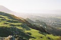
English: Meliden is a village between Prestatyn and Dyserth in Denbighshire, Wales. It grew up around the locality of lead mines and limestone quarries. The placename "Meliden" has variously been claimed to be derived from that of Bishop Melitus or St. Melyd (the village has the church of St. Melyd as its main place of worship); its Welsh placename, "Gallt Melyd", means "wooded hill of Melyd". The railway between Prestatyn and Dyserth, long since lifted and formerly with sidings in the village, is now a public walkway and nature trek. It has a 9-hole golf course, which is split in half by the former railway/nature walk. The local school, St. Melyd Primary, is a feeder school to the High School, Prestatyn.
village in United Kingdom  _un_o_Fryniau_Clwyd,_AONB_a_SSSI_25.png) | |||||
| Upload media | |||||
| Pronunciation audio | |||||
|---|---|---|---|---|---|
| Instance of | |||||
| Location | Prestatyn, Denbighshire, Wales | ||||
 | |||||
Subcategories
This category has the following 2 subcategories, out of 2 total.
G
S
- St Melyd's Church, Meliden (23 F)
Media in category "Meliden"
The following 42 files are in this category, out of 42 total.
-
 Bungalows - geograph.org.uk - 32216.jpg 576 × 432; 33 KB
-
 Good shed Meliden.JPG 4,288 × 3,216; 3.65 MB
-
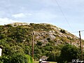 Graig Fawr Sunny (enhanced).jpg 960 × 720; 116 KB
-
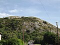 Graig Fawr Sunny.jpg 3,072 × 2,304; 2.05 MB
-
 Graig Fawr, Diserth, Sir Ddinbych, Cymru (Wales) un o Fryniau Clwyd, AONB a SSSI 25.png 3,840 × 2,160; 11.99 MB
-
 Kingdom Hall of Jehovahs Witnesses - geograph.org.uk - 32196.jpg 576 × 432; 33 KB
-
 Maize field and covert - geograph.org.uk - 32194.jpg 576 × 432; 53 KB
-
 Meliden Masonic Hall - geograph.org.uk - 657599.jpg 640 × 451; 51 KB
-
 Offa's Dyke Path on Prestatyn Hillside - geograph.org.uk - 1334574.jpg 640 × 480; 105 KB
-

-
 On the Offa's Dyke Path above Tan-yr-Allt - geograph.org.uk - 541336.jpg 498 × 640; 117 KB
-
 Ordnance Survey Drawings - Meliden (OSD 323).jpg 4,000 × 3,091; 3.33 MB
-

-
 Rhydwen Farm Mews - geograph.org.uk - 32190.jpg 576 × 432; 54 KB
-

-
 Salem Methodist Chapel, Meliden - geograph.org.uk - 657671.jpg 640 × 480; 60 KB
-
 Sheep Feeder - geograph.org.uk - 32213.jpg 576 × 432; 72 KB
-
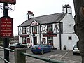 The Red Lion, Meliden - geograph.org.uk - 657601.jpg 640 × 480; 80 KB
-
 Above Prestatyn on the Offa's Dyke Path - geograph.org.uk - 541332.jpg 640 × 480; 104 KB
-
 Churchyard, Meliden - geograph.org.uk - 657597.jpg 640 × 480; 125 KB
-
 Cottages, Meliden - geograph.org.uk - 657673.jpg 640 × 480; 60 KB
-
 Disused railway line at Meliden - geograph.org.uk - 31115.jpg 512 × 384; 63 KB
-
 Farm Road - geograph.org.uk - 32212.jpg 576 × 432; 47 KB
-

-
 Graig Fawr - geograph.org.uk - 105291.jpg 640 × 480; 59 KB
-
 Graig Fawr to the mountains - geograph.org.uk - 105295.jpg 640 × 480; 56 KB
-
 Graig Fawr to the windfarms - geograph.org.uk - 105285.jpg 640 × 480; 36 KB
-
 Graig Fawr trig point - geograph.org.uk - 105278.jpg 640 × 480; 66 KB
-
 Graig Fawr View - geograph.org.uk - 105283.jpg 640 × 480; 65 KB
-
 Graig Fawr view - geograph.org.uk - 498578.jpg 640 × 419; 62 KB
-
 Gwaenysgor duckpond - geograph.org.uk - 151638.jpg 640 × 480; 67 KB
-
 Gwaenysgor Viewpoint - geograph.org.uk - 671383.jpg 640 × 480; 40 KB
-
 Holiday Caravan Park - geograph.org.uk - 32215.jpg 576 × 432; 47 KB
-
 Meliden Hills - geograph.org.uk - 76731.jpg 512 × 384; 27 KB
-
 Melyd Avenue, Prestatyn - geograph.org.uk - 657593.jpg 640 × 480; 55 KB
-

-
 Overgrown Public Footpath - geograph.org.uk - 32210.jpg 576 × 432; 73 KB
-
 Pond at Gwaenysgor - geograph.org.uk - 671385.jpg 640 × 480; 54 KB
-
 Prestatyn from Gwaenysgor - geograph.org.uk - 72017.jpg 560 × 386; 45 KB
-

-
 Sign marking Public Footpath - geograph.org.uk - 32209.jpg 576 × 432; 77 KB
-
 Two signs - geograph.org.uk - 32191.jpg 576 × 432; 78 KB


.jpg)


.jpg)


