Category:Denbighshire
Jump to navigation
Jump to search

principal area in north-east Wales    | |||||
| Upload media | |||||
| Instance of | |||||
|---|---|---|---|---|---|
| Location | Wales | ||||
| Located in or next to body of water | |||||
| Capital | |||||
| Inception |
| ||||
| Population |
| ||||
| Area |
| ||||
| Replaces |
| ||||
| Different from | |||||
| official website | |||||
 | |||||

Denbighshire in north Wales is a principal area, historic county and part of the preserved county of Clwyd.
Subcategories
This category has the following 28 subcategories, out of 28 total.
Media in category "Denbighshire"
The following 200 files are in this category, out of 385 total.
(previous page) (next page)-
 A5104 at Clawdd Poncen (geograph 3392566).jpg 4,608 × 3,456; 3.29 MB
-
 Abandoned quarry - geograph.org.uk - 1254241.jpg 640 × 428; 104 KB
-
 Argentinian Artillery - geograph.org.uk - 1103853.jpg 640 × 480; 131 KB
-
 Arms of Denbighshire County Council.svg 1,095 × 1,130; 466 KB
-
 At the starting line ... - geograph.org.uk - 1303338.jpg 640 × 471; 62 KB
-
 Bathafern Hills, from Coedmarchan Rocks.jpeg 800 × 646; 125 KB
-
 Beef cattle at Glan Aber Farm - geograph.org.uk - 292176.jpg 640 × 480; 98 KB
-
 Beehives in woodland near Aberwheeler - geograph.org.uk - 1153393.jpg 640 × 480; 142 KB
-
 Belt and braces - geograph.org.uk - 1254422.jpg 640 × 428; 67 KB
-
 Bench with a view - geograph.org.uk - 959920.jpg 640 × 480; 42 KB
-
 Berwyn Viaducts - geograph.org.uk - 862052.jpg 640 × 428; 125 KB
-
 Big Covert07LB.jpg 4,608 × 3,456; 5.71 MB
-
 Big Covert08LB.jpg 2,816 × 2,112; 1.81 MB
-
 BigCovert03LB.jpg 2,816 × 2,112; 3.4 MB
-
 BigCovert04.jpg 2,816 × 2,112; 4.35 MB
-
 BigCovert05LB.jpg 2,816 × 2,112; 1.39 MB
-
 BigCovert09LB.jpg 2,816 × 2,112; 2.11 MB
-
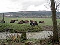 Bison on the Rhug estate - 2 - geograph.org.uk - 727517.jpg 640 × 480; 94 KB
-
 Black-faced sheep with lambs - geograph.org.uk - 1155531.jpg 640 × 480; 78 KB
-
 Boncyn Arian - geograph.org.uk - 982106.jpg 640 × 480; 78 KB
-
 Bridleway and mounting steps - geograph.org.uk - 1261467.jpg 640 × 480; 135 KB
-
 Bridleway and stone wall below Fron Hen - geograph.org.uk - 1252821.jpg 640 × 480; 163 KB
-
 Bridleway below Fron Hen - geograph.org.uk - 1251802.jpg 640 × 480; 172 KB
-
 Bridleway below Fron Hen - geograph.org.uk - 1252554.jpg 640 × 480; 142 KB
-
 Bridleway below Fron Hen - geograph.org.uk - 1371097.jpg 640 × 480; 214 KB
-
 Bridleway near Craig-y-Ddywart quarry - geograph.org.uk - 1122708.jpg 480 × 640; 104 KB
-
 Bridleway to Foel Farm and beyond - geograph.org.uk - 1806081.jpg 480 × 640; 147 KB
-
-
 Bryn Hen - geograph.org.uk - 782530.jpg 640 × 480; 79 KB
-
 Bryn Rhydd, Rhuthun - geograph.org.uk - 990959.jpg 640 × 480; 83 KB
-
 Bryn-Llwyd above Cyffylliog Denbighshire - geograph.org.uk - 1108389.jpg 640 × 480; 133 KB
-
 Cabling over the countryside - geograph.org.uk - 243084.jpg 477 × 640; 53 KB
-
 Canal Bridge under A542 - geograph.org.uk - 1731945.jpg 530 × 640; 88 KB
-
 Carrog by the Dee - panoramio.jpg 2,944 × 1,656; 1.22 MB
-
 Castell Dinas Bran - geograph.org.uk - 1023548.jpg 640 × 480; 76 KB
-

-
 Castell Dinas Bran from the north - geograph.org.uk - 919654.jpg 640 × 479; 67 KB
-
 Castell Dinas Bran on Christmas Day - geograph.org.uk - 1632394.jpg 640 × 428; 76 KB
-
 Clwydian Way - geograph.org.uk - 1023558.jpg 640 × 480; 90 KB
-
 Clwydian Way - geograph.org.uk - 1023563.jpg 640 × 480; 146 KB
-
 Clwydian Way - geograph.org.uk - 1178896.jpg 640 × 480; 79 KB
-
 Clwydian Way - geograph.org.uk - 1327761.jpg 640 × 480; 69 KB
-
 Clwydian Way - geograph.org.uk - 1346629.jpg 640 × 480; 102 KB
-
 Clwydian Way at edge of Coed y Fedw - geograph.org.uk - 1327688.jpg 640 × 480; 146 KB
-
 Clwydian Way crossing Bryn Alyn - geograph.org.uk - 1327825.jpg 640 × 480; 58 KB
-
 Clwydian Way north of Aberduna - geograph.org.uk - 1327690.jpg 480 × 640; 138 KB
-
 Clwydian Way north of Maeshafn - geograph.org.uk - 1327696.jpg 480 × 640; 126 KB
-
 Clwydian Way south of Maeshafn - geograph.org.uk - 1327699.jpg 480 × 640; 145 KB
-
 Corner of a lane near Geinas - geograph.org.uk - 1323598.jpg 640 × 480; 129 KB
-
 Corwen Rugby Club - geograph.org.uk - 1559841.jpg 630 × 162; 60 KB
-
 Culvert under the A494(T) - geograph.org.uk - 1261720.jpg 640 × 480; 168 KB
-
 Curved track below Fron Hen - geograph.org.uk - 1245150.jpg 640 × 480; 170 KB
-
 Cyrn y Brain.jpg 5,184 × 3,456; 6.72 MB
-
 Dee Riverside - panoramio.jpg 2,944 × 1,656; 1.07 MB
-
 Dee Side Cafe, River Dee, Llangollen, Denbighshire, Wales (28717314491).jpg 7,250 × 4,276; 12.28 MB
-
 Denbigh Gliding club airfield - geograph.org.uk - 1161663.jpg 640 × 480; 58 KB
-
 Denbighshire County Council 2024.svg 360 × 185; 4 KB
-
 DENBIGHSHIRE COUNTY COUNCIL Shield.svg 600 × 660; 1.07 MB
-
 Ditch-digging - geograph.org.uk - 1806128.jpg 640 × 480; 115 KB
-
 Eglwyseg (2011.10.16).jpg 4,256 × 2,832; 13.73 MB
-
 Elwy Valley landscape - geograph.org.uk - 782531.jpg 640 × 480; 84 KB
-
 Eroded footpath on Moel y Gamelin - geograph.org.uk - 1587534.jpg 640 × 480; 109 KB
-
 Every child's dream house - geograph.org.uk - 1178819.jpg 480 × 640; 140 KB
-
 Eyarth Rocks - geograph.org.uk - 244401.jpg 480 × 640; 155 KB
-
 Faenol Fawr, Bodelwyddan 16.JPG 4,000 × 3,000; 3.56 MB
-
 Faenol Fawr, Bodelwyddan 17.JPG 4,000 × 3,000; 3.49 MB
-

-
 Farm road to Sychnant - geograph.org.uk - 1584930.jpg 640 × 480; 59 KB
-
 Farm steading at Rhos Pengwern - geograph.org.uk - 1251640.jpg 640 × 428; 70 KB
-
 Farm track through the trees - geograph.org.uk - 1654423.jpg 640 × 428; 109 KB
-
 Farmland west of Llanrhaeadr - geograph.org.uk - 791540.jpg 640 × 480; 73 KB
-
 Farmyard, Wern To - geograph.org.uk - 803835.jpg 640 × 445; 111 KB
-
 Feeding time for the milking ewes - geograph.org.uk - 1211523.jpg 640 × 428; 80 KB
-

-

-
 Felled timber awaiting up lifting - geograph.org.uk - 1251553.jpg 640 × 428; 104 KB
-
 Ffrith Fedw - geograph.org.uk - 803149.jpg 640 × 480; 91 KB
-

-
 Fields, Nant Mawr - geograph.org.uk - 1218399.jpg 640 × 470; 90 KB
-
 Finger Post - geograph.org.uk - 812411.jpg 427 × 640; 124 KB
-
 Flypast at Rhyl - geograph.org.uk - 1571660.jpg 640 × 444; 31 KB
-
 Foel Fawr - geograph.org.uk - 1625576.jpg 640 × 480; 128 KB
-
 Footbridge over the A55 Expressway - geograph.org.uk - 1736764.jpg 3,648 × 2,736; 3.64 MB
-

-

-
 Footpath back towards Llangollen - geograph.org.uk - 1219698.jpg 640 × 428; 95 KB
-

-

-
 Footpath crosses the Llwybr Ceiriog - geograph.org.uk - 1254344.jpg 640 × 428; 98 KB
-

-
 Footpath on slopes of Moel Dywyll - geograph.org.uk - 1171815.jpg 640 × 480; 67 KB
-
 Footpath on slopes of Moel Dywyll - geograph.org.uk - 1171817.jpg 640 × 480; 78 KB
-
 Footpath on the moor - geograph.org.uk - 1739015.jpg 2,048 × 1,360; 1.96 MB
-
 Footpath on tramway level - geograph.org.uk - 1297289.jpg 640 × 480; 92 KB
-

-

-
 Footpath to Pant Du - geograph.org.uk - 1811419.jpg 640 × 480; 122 KB
-
 Forest track in Coed Moel Famau - geograph.org.uk - 1193356.jpg 640 × 480; 213 KB
-
 Forestry clearfell - geograph.org.uk - 1251571.jpg 640 × 428; 85 KB
-
 Forestry lorry manoeuvring - geograph.org.uk - 1245359.jpg 640 × 480; 177 KB
-
 Former mill, now a country cottage - geograph.org.uk - 1219776.jpg 640 × 428; 124 KB
-
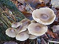
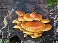
 Fungi - geograph.org.uk - 292110.jpg 640 × 480; 146 KB
-
 Gate alongside Offa's Dyke - geograph.org.uk - 1723583.jpg 640 × 474; 84 KB
-
 Gate and stile on Cyrn-y-Brain track - geograph.org.uk - 1210826.jpg 640 × 427; 133 KB
-
 Gate to Canal side property - geograph.org.uk - 1243927.jpg 640 × 480; 123 KB
-
 Gateway and wall line below Fron Hen - geograph.org.uk - 1244482.jpg 640 × 480; 154 KB
-

-
 Golden evening light on Ruabon Mountain - geograph.org.uk - 1239231.jpg 640 × 437; 208 KB
-

-
 Grassland that is not being grazed - geograph.org.uk - 1254444.jpg 640 × 428; 76 KB
-
 Grazing beside the Nant-y-Bache - geograph.org.uk - 1251517.jpg 640 × 428; 66 KB
-

-
 Heather on Moel Famau - geograph.org.uk - 1095561.jpg 640 × 480; 49 KB
-
 Hill Fort 2014.jpg 3,872 × 2,592; 2.35 MB
-
 Horseshoe Pass - geograph.org.uk - 1005780.jpg 640 × 481; 72 KB
-
 Horseshoe Pass - geograph.org.uk - 1243929.jpg 640 × 480; 45 KB
-
 Horseshoe Pass - geograph.org.uk - 973602.jpg 640 × 480; 52 KB
-
 HorseshoePassPonderosaWinter.jpg 5,184 × 3,456; 5.21 MB
-
 HorseshoePassViewSE.jpg 5,184 × 3,456; 7.08 MB
-
 HorseshoePassViewSW.jpg 3,456 × 5,184; 5.98 MB
-
 HorseshoePassWinterScrubland.jpg 5,184 × 3,456; 5.9 MB
-
 HorsesoePassViewNE.jpg 5,184 × 3,456; 6.45 MB
-
 House and Barn at Rhewl - geograph.org.uk - 82704.jpg 640 × 480; 157 KB
-
 House at the crossroads - geograph.org.uk - 1042136.jpg 640 × 480; 94 KB
-
 It's downhill most of the way - geograph.org.uk - 1254308.jpg 640 × 428; 98 KB
-

-

-
 Junction, on the A5, at Ty'n-y-cefn - geograph.org.uk - 1411037.jpg 640 × 472; 77 KB
-
 Kinmel Park.png 934 × 755; 1,016 KB
-
 Ladder stile on Taith Clwyd - geograph.org.uk - 1659245.jpg 640 × 453; 95 KB
-
 Leaning tree on Ruabon Mountain - geograph.org.uk - 1238399.jpg 640 × 427; 171 KB
-
 Leisurely ride. - geograph.org.uk - 676439.jpg 640 × 480; 96 KB
-
 Limestone escarpment - World's End - geograph.org.uk - 27578.jpg 480 × 640; 104 KB
-
 Llandegla Forest - geograph.org.uk - 1179754.jpg 640 × 480; 63 KB
-
 Llandegla sewage pumping station - geograph.org.uk - 1304890.jpg 640 × 480; 91 KB
-
 Llandegla Well 2019 (1).jpg 5,312 × 3,984; 9.87 MB
-
 Llandegla Well 2019 (2).jpg 5,312 × 3,984; 10.35 MB
-
 Llandrillo townships.svg 1,000 × 851; 65 KB
-

-
 Llansilio - in Denbighshire, the seat of Thos. Jones esq.jpeg 900 × 617; 375 KB
-
 Lletty Farm - geograph.org.uk - 1042157.jpg 640 × 480; 67 KB
-
 Llwybr Ceiriog above Pengwern Vale - geograph.org.uk - 1254453.jpg 640 × 428; 74 KB
-
 Llwybr Ceiriog goes along the lane - geograph.org.uk - 1254385.jpg 640 × 428; 69 KB
-
 Llwybr Ceiriog goes ever eastward - geograph.org.uk - 1254187.jpg 640 × 428; 81 KB
-
 Llwybr Ceiriog leaves the lane - geograph.org.uk - 1254436.jpg 640 × 428; 90 KB
-
 Llwybr Ceiriog westward - geograph.org.uk - 1254411.jpg 640 × 428; 89 KB
-
 Llwybr Gogledd y Berwyn - geograph.org.uk - 1652165.jpg 640 × 410; 94 KB
-

-
 Llwybr Gogledd y Berwyn steadly climbing - geograph.org.uk - 1250994.jpg 640 × 428; 149 KB
-
 Llyn Brenig in the evening - geograph.org.uk - 1346499.jpg 640 × 480; 65 KB
-
 Loggerheads Wyddgrug Rhuthun 02.JPG 2,048 × 3,648; 1.48 MB
-
 Loggerheads Wyddgrug Rhuthun 08.JPG 3,648 × 2,048; 2.5 MB
-
 Logo Menter Iaith Sir Ddinbych.png 734 × 370; 29 KB
-
 Looking back over the moors to Rhydtalog - geograph.org.uk - 1718588.jpg 640 × 480; 206 KB
-

-
 Looking North along A542 - geograph.org.uk - 1731910.jpg 640 × 480; 60 KB
-
 Looking south from the Horseshoe Pass - geograph.org.uk - 980500.jpg 640 × 480; 54 KB
-
 Low lying land to the north of Ruthin - geograph.org.uk - 1122673.jpg 640 × 480; 104 KB
-
 Map showing the traditional, geographical county of Denbighshire Sir Ddinbych, Wales.png 4,967 × 4,967; 4.13 MB
-
 Meyarth Hall - geograph.org.uk - 1309655.jpg 640 × 480; 56 KB
-
 Military Debris - geograph.org.uk - 1103870.jpg 640 × 480; 111 KB
-
 Milk stand - geograph.org.uk - 129187.jpg 640 × 480; 146 KB
-
 Moel Famau from the West. - geograph.org.uk - 760520.jpg 480 × 640; 66 KB
-
 Moel Famau Summit. - geograph.org.uk - 1095567.jpg 640 × 480; 66 KB
-
 Moel Famau Summit. - geograph.org.uk - 760254.jpg 640 × 480; 69 KB
-
 Moel fferna.jpg 4,032 × 3,024; 3.99 MB
-

-
-

-

-
-
 Moorland in the Berwyns near Moel Sych - geograph.org.uk - 972012.jpg 640 × 480; 104 KB
-

-
Mynydd Llantysilio.webm 2 min 5 s, 1,920 × 1,080; 33.19 MB
-
 Mynydd Rhyd Ddu - geograph.org.uk - 1307583.jpg 640 × 480; 40 KB
-
 Nantglyn Cottages - geograph.org.uk - 1157898.jpg 640 × 480; 61 KB
-
 Neuadd Gofla, Llandegla - geograph.org.uk - 1310843.jpg 640 × 480; 75 KB
-
 North Berwyn Way above Nant y Bache - geograph.org.uk - 645999.jpg 640 × 428; 53 KB
-
 Now that is an open horizon - geograph.org.uk - 1254294.jpg 640 × 428; 81 KB
-

-
 Offa's Dyke LDP nearly at Moel Famau - geograph.org.uk - 1030716.jpg 640 × 480; 51 KB
-

-
 Offa's Dyke Path - geograph.org.uk - 773637.jpg 480 × 640; 141 KB
-

-
 Offa's Dyke Path at Bwlch Pen Barras - geograph.org.uk - 1027805.jpg 640 × 480; 59 KB
-

-

-

-

-

-
 Offa's Dyke Path-Private Road. - geograph.org.uk - 644920.jpg 640 × 480; 134 KB
-
 Old Derelict House south of Maeshafn - geograph.org.uk - 1327714.jpg 640 × 480; 104 KB
-

-
 Old trackway and trees below Fron Hen - geograph.org.uk - 1241338.jpg 640 × 480; 155 KB
-

-
 Optimistic milage - geograph.org.uk - 1251232.jpg 640 × 428; 41 KB
-
 Over, under and up onto - geograph.org.uk - 1639701.jpg 640 × 429; 97 KB
-

-

-
 Passing place on the lane to Maeshafn - geograph.org.uk - 1266487.jpg 640 × 480; 199 KB
.jpg)


_-_geograph.org.uk_-_1261720.jpg)


.jpg)


.jpg)


.jpg)
.jpg)


