Category:Maps showing the 700s
Jump to navigation
Jump to search
| Maps showing the 8th century: |
Not to be confused with maps made in the 700s.
Media in category "Maps showing the 700s"
The following 7 files are in this category, out of 7 total.
-
Battle of Anchialus (708)-zh.png 1,479 × 1,319; 455 KB
-
Battle of Anchialus (708).png 1,479 × 1,319; 648 KB
-
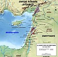
Le Levant sous les Omeyyades vers 700 EC.jpg 768 × 752; 114 KB
-
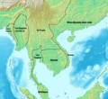
Mainland Southeast Asia around 700 CE.png 1,800 × 1,656; 2.65 MB
-
Mainland Southeast Asia in 700 CE (cropped).png 1,800 × 1,656; 2.67 MB
-
Mainland Southeast Asia in 700 CE.png 1,800 × 1,800; 2.7 MB
-
Origins 700.png 670 × 458; 620 KB


