Category:Maps showing 1812
Jump to navigation
Jump to search
| ← 1810 1811 1812 1813 1814 1815 1816 1817 1818 1819→ |
English: Maps showing the year 1812 (i.e. history maps)
See also category: 1812 maps. and 1810s maps for more maps showing this year usually created not long after the given year.
See also category: 1812 maps. and 1810s maps for more maps showing this year usually created not long after the given year.
Subcategories
This category has the following 6 subcategories, out of 6 total.
M
U
Media in category "Maps showing 1812"
The following 19 files are in this category, out of 19 total.
-
1812PRINCIPATE.png 3,445 × 1,937; 606 KB
-
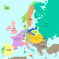
Blank map of Europe 1812.svg 450 × 456; 632 KB
-
C. 1812 Central Europe.jpg 1,552 × 1,200; 1.47 MB
-
Carte 134 départements.png 800 × 1,013; 636 KB
-
Europa 1812-es.svg 1,357 × 1,357; 1 MB
-
Europa 1812.svg 1,357 × 1,357; 511 KB
-
Europe 1812 map ar.png 2,284 × 1,503; 1.18 MB
-
Europe en 1812 (c. 1854).jpg 2,867 × 2,282; 5.11 MB
-
First French Empire 1812.svg 450 × 456; 464 KB
-
French Empire in September 1812.png 1,895 × 1,920; 646 KB
-
Fürstentum Erfurt 1812.svg 450 × 456; 445 KB
-
Landkarte New Madrid Erdbeben.jpg 467 × 474; 42 KB
-
Life-expectancy,Africa,1812.svg 850 × 691; 12 KB
-
Life-expectancy,World,1812.svg 850 × 691; 12 KB
-
Russian map of the Battle of Tarutino 1812.jpg 1,715 × 2,711; 635 KB
-
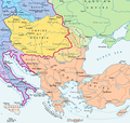
Southeast Europe 1812 map en.PNG 1,203 × 1,144; 623 KB
-
United States 1810-10-1812-04.png 1,000 × 677; 108 KB
-
United States 1812-04-1812-05.png 1,000 × 677; 105 KB
-
United States 1812-05-1812-06.png 1,000 × 677; 105 KB


