Category:Maps showing 1820
Jump to navigation
Jump to search
| ← 1820 1821 1822 1823 1824 1825 1826 1827 1828 1829→ |
English: Maps showing the year 1820 (i.e. history maps)
See also category: 1820 maps. and 1820s maps for more maps showing this year usually created not long after the given year.
See also category: 1820 maps. and 1820s maps for more maps showing this year usually created not long after the given year.
Subcategories
This category has only the following subcategory.
U
Media in category "Maps showing 1820"
The following 9 files are in this category, out of 9 total.
-
Black Americans 1820 County.png 14,818 × 9,000; 5.31 MB
-
Life-expectancy,Africa,1820.svg 850 × 691; 12 KB
-
Life-expectancy,World,1820.svg 850 × 691; 12 KB
-
Map of the Missouri Compromise, 1820.jpg 3,288 × 2,378; 1.54 MB
-
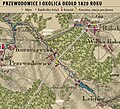
Przewodowice 1820 r..jpg 1,126 × 1,020; 1.41 MB
-
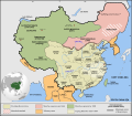
Qing Empire circa 1820 EN.svg 849 × 742; 548 KB
-
United States 1820-1821-07.png 1,000 × 677; 108 KB
-
White Americans 1820 County.png 14,818 × 9,000; 8.39 MB
-
מפת אימפריית צ'ינג בשנת 1820.png 1,610 × 1,175; 823 KB


