Category:Maps of weather and climate of South America
Jump to navigation
Jump to search
Temperate regions: North America · South America · Africa · Europe · Asia · Oceania – Polar regions: Antarctica · Arctic – Other regions:
Subcategories
This category has the following 16 subcategories, out of 16 total.
A
B
C
E
I
M
P
S
U
V
Media in category "Maps of weather and climate of South America"
The following 21 files are in this category, out of 21 total.
-
1cavg15 202308 Northern South America average temperatures.png 3,000 × 3,000; 901 KB
-
1cpcp15 202308 Northern South America total precipitation.png 3,000 × 3,000; 1.38 MB
-
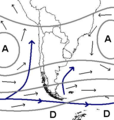
Cartasinoptica.jpg 391 × 264; 48 KB
-
Clima altoandino intertropical.png 456 × 626; 62 KB
-
Clima de Chile fr.png 384 × 404; 96 KB
-
Clima de Chile.JPG 384 × 404; 30 KB
-
Koppen-Geiger Map FLK future.svg 1,816 × 850; 3.23 MB
-
Koppen-Geiger Map South America future.svg 1,294 × 850; 5.17 MB
-
Koppen-Geiger Map South America present.svg 1,294 × 850; 5.3 MB
-
Lowest and highest temperatures ever recorded in South America.jpg 1,414 × 1,467; 288 KB
-
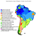
Mapa climático de Sudamérica (Köppen-Geiger).png 1,856 × 1,682; 745 KB
-
Movement of surface waters during El Nino.jpg 2,512 × 1,286; 330 KB
-
Regione Neotropicale.jpg 480 × 706; 42 KB
-
South America Köppen Map.png 1,200 × 1,821; 642 KB
-
South America map of Köppen climate classification.svg 1,900 × 1,900; 1.37 MB
-
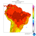
Wcmax15 20230723-20230729 Northern South America maximum temperatures.png 2,000 × 2,000; 549 KB
-
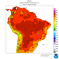
Wcmax15 20230730-20230805 Northern South America maximum temperatures.png 2,000 × 2,000; 552 KB
-
Wcmax8 20230723-20230729 Southern South America maximum temperatures.png 1,700 × 2,000; 410 KB
-
Wcmax8 20230730-20230805 Southern South America maximum temperatures.png 1,700 × 2,000; 407 KB


