Category:Maps of trade routes
Jump to navigation
Jump to search
Subcategories
This category has the following 7 subcategories, out of 7 total.
M
- Maps of the Silk Road (62 F)
- Maps of the triangular trade (23 F)
Media in category "Maps of trade routes"
The following 100 files are in this category, out of 100 total.
-
16th century Portuguese Spanish trade routes.png 2,835 × 1,188; 2 MB
-
1845 trailmap.png 993 × 589; 37 KB
-
2016 Singapur, Downtown Core, Muzeum Cywilizacji Azjatyckich, Ekspozycja (002).jpg 5,365 × 3,018; 9.96 MB
-
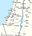
Ancient Levant routes.png 919 × 622; 290 KB
-
Andres Urdaneta Tornaviaje.jpg 1,590 × 1,306; 1.54 MB
-
Austronesian maritime trade network in the Indian Ocean.png 2,895 × 2,100; 1.91 MB
-
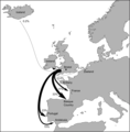
Bristol trade routes1492.png 1,735 × 1,761; 330 KB
-
C+B-Trade-Map1-HitherAsiaTradeRoutes.JPG 1,690 × 1,244; 552 KB
-
C+B-Trade-Map2-PalestineTradeRoutes.JPG 845 × 1,287; 297 KB
-
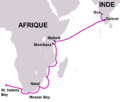
Caminho maritimo para a India heb.svg 1,052 × 744; 149 KB
-
Caminho maritimo para a India-HE.png 556 × 396; 38 KB
-
Caminho maritimo para a India.png 556 × 396; 39 KB
-
Carreira da India de.svg 1,054 × 654; 848 KB
-
Carreira da India es.svg 1,054 × 654; 604 KB
-
CastilianInternationalTrade.jpg 643 × 392; 65 KB
-
Central Asian trade routes V2.jpg 1,280 × 836; 398 KB
-
Central Asian trade routes.jpg 954 × 674; 206 KB
-
Commerce transsaharien.jpg 2,214 × 1,488; 1.33 MB
-
Croisettes en hun handelsroutes tijdens de 19de eeuw.png 797 × 565; 401 KB
-
D355- Quelques Routes de la Civilisation mondiale. -L1-Ch 6.png 1,510 × 1,984; 62 KB
-
Democratic Ideals and Reality, 1919 Fig 26 p 144-5.jpg 2,541 × 2,295; 545 KB
-
Democratic Ideals and Reality, 1919 Fig 26L p 144.jpg 1,266 × 2,045; 278 KB
-
Democratic Ideals and Reality, 1919 Fig 26R p 145.jpg 1,288 × 2,338; 266 KB
-
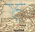
Doornik handelsroutes.jpg 1,366 × 1,258; 865 KB
-
Empires voies commerciales.jpg 663 × 500; 169 KB
-
Esclavatge - Comèrci mondiau sègle XVIII.png 2,727 × 2,249; 1,004 KB
-
Europa BV042517765 (cropped).jpg 1,472 × 1,948; 293 KB
-
Gama route 1 FR.png 875 × 745; 22 KB
-
Gama route 1 ml.svg 875 × 715; 86 KB
-
Gama route 1 zh-hans.svg 875 × 715; 122 KB
-
Gama route 1 zh-hant.svg 875 × 715; 135 KB
-
Gama route 1.png 875 × 715; 15 KB
-
Gama route 1.svg 875 × 715; 82 KB
-
Great Trading Routes of the Sahara WDL100.png 1,436 × 1,024; 2.32 MB
-
Grody czerwienskie szlaki.png 824 × 605; 932 KB
-
Handelsrouten der Philister.jpg 833 × 957; 178 KB
-
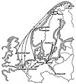
HL Damals – Possehl – Erzhandel – Transportwege.jpg 1,149 × 1,270; 326 KB
-
Itinerari dei mercanti lombardi e genovesi nel Medioevo.svg 430 × 656; 556 KB
-
Karte Handelsweg Brandau rot.jpg 964 × 1,459; 288 KB
-
Karte Handelsweg Brandau.jpg 964 × 1,459; 282 KB
-
Kaufmännische wandkarte der erde zur übersicht der handelsbeziehungen - (13384166534).jpg 2,000 × 1,310; 2.51 MB
-
Kievan Rus and trade routes in 9th century (ru).svg 1,200 × 1,302; 244 KB
-
Lange diercke sachsen erdkarten deutschlands welthandel.jpg 4,704 × 2,036; 3.28 MB
-
Late Medieval Trade Routes hu.svg 1,457 × 1,088; 523 KB
-
Late Medieval Trade Routes.jpg 1,457 × 1,088; 372 KB
-
Macau Trade Routes-ar.png 1,425 × 625; 62 KB
-
Macau Trade Routes.png 1,425 × 625; 58 KB
-
Map India and Pakistan 1-250,000 Tile NI 43-4 Chulung.jpg 5,000 × 3,791; 3.62 MB
-
Map of Portuguese Carreira da India.gif 1,047 × 593; 69 KB
-
Mapa das Rotas Comerciais .jpg 495 × 751; 190 KB
-
Middle Corridor Route.svg 512 × 191; 991 KB
-
New Silk Road - ru.svg 1,174 × 647; 237 KB
-
New Silk Road -es.svg 1,174 × 647; 266 KB
-
Northern part of Eastern Europe 01.png 3,876 × 2,851; 3 MB
-
Northern part of Eastern Europe 02 (ru).png 1,002 × 941; 298 KB
-
Northern part of Eastern Europe 02.svg 1,200 × 1,302; 187 KB
-
Nova Ruta de la Seda.svg 1,174 × 647; 111 KB
-
Obsidian trade (IV millennium BC).png 467 × 452; 67 KB
-
Palmyra trade.png 1,194 × 716; 340 KB
-
Paulitschke map of Somaliland and the interior.png 1,915 × 881; 4 MB
-
PhoenicianTrade ca.svg 2,000 × 1,000; 347 KB
-
Portuguese discoveries and explorationsV2en.png 1,357 × 628; 213 KB
-
Radhanites2.png 1,201 × 601; 1.41 MB
-
Route rubrouck 1253 55.JPG 760 × 324; 57 KB
-
Routes commerciales maritimes.jpg 2,000 × 998; 368 KB
-
Searoutes taken by amateur sailors.png 1,425 × 625; 87 KB
-
Shah ghazi rustam - trade routes.png 331 × 277; 5 KB
-
Shipping routes red black.png 3,600 × 1,800; 2.63 MB
-
Shipping routes.png 3,600 × 1,800; 1.25 MB
-
Somalian Piracy Threat 2010 map-fr.svg 3,389 × 2,436; 2.88 MB
-
Szlaki drogowe sujkowski.png 1,175 × 764; 1,021 KB
-
Tanais Museum 22.jpg 3,261 × 2,540; 4.27 MB
-
Trade Routes.jpg 1,500 × 1,383; 188 KB
-
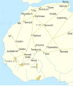
Trans-Saharan routes early-es.svg 512 × 597; 208 KB
-
Trans-Saharan routes early-pt.svg 512 × 597; 102 KB
-
Trans-Saharan routes early.svg 512 × 597; 102 KB
-
Triangle trade.png 448 × 327; 246 KB
-
US trade final-01.svg 935 × 598; 1.5 MB
-
Varangian routes-ar.png 872 × 605; 1,010 KB
-
Varangian routes.png 872 × 605; 859 KB
-
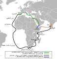
Vasco de Gama map-ar.svg 1,087 × 1,124; 887 KB
-
Vasco de Gama map-fr.svg 1,087 × 1,124; 887 KB
-
Via Augusta map-fr.svg 1,261 × 1,051; 554 KB
-
Viking Age trade routes in north-west Europe.png 994 × 967; 441 KB
-
VitalienbruederOstsee.png 1,600 × 1,596; 1.18 MB
-
Western Regions 1st century BC (ja).png 680 × 425; 633 KB
-
World Ice Trade, 1856.png 2,000 × 1,222; 674 KB
-
Музей Горгиппия. Экспонат. (02) Карта Боспорского царства.jpg 3,715 × 2,322; 3.72 MB
-
Музей Горгиппия. Экспонат. (47).jpg 3,344 × 2,322; 4.45 MB
-
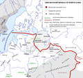
Торговые пути Восточной Европы в IX веке.png 752 × 819; 235 KB
-
Торговые пути Восточной Европы в X веке.png 753 × 819; 268 KB
-
أهم خطوط التجارة الدوليّة في حوض المتوسّط حوالي سنة 1300م.jpg 1,183 × 558; 256 KB
-
اكتشافات البرتغاليين.jpg 854 × 703; 188 KB


