Category:Maps of Spanish trade routes
Jump to navigation
Jump to search
Subcategories
This category has the following 2 subcategories, out of 2 total.
M
- Santa Fe Trail-maps (27 F)
Media in category "Maps of Spanish trade routes"
The following 17 files are in this category, out of 17 total.
-
16th century Portuguese Spanish trade routes.png 2,835 × 1,188; 2 MB
-
16th century Spanish trade routes.png 2,835 × 1,188; 775 KB
-
Camino Español.PNG 323 × 569; 110 KB
-
CaminoEspañol-NL.svg 449 × 614; 1.89 MB
-
CaminoEspañol.svg 449 × 614; 1.25 MB
-
CaminoRealAdentro.png 698 × 682; 374 KB
-
El Camino Español.PNG 898 × 720; 348 KB
-
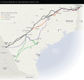
El Camino Real de los Tejas National Historic Trail.png 630 × 606; 222 KB
-
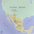
El Camino Real Map.png 286 × 186; 36 KB
-
Expedición de Drake y Hawkins 1595-1596.jpg 1,797 × 1,195; 1.26 MB
-
Expedición de Francis Drake 1585-1586.jpg 1,787 × 1,145; 866 KB
-
Map WestIndies SpanishTreasureRoutes 1726.svg 737 × 411; 3.39 MB
-
OldSpanishNationalHistoricTrail.png 1,643 × 1,043; 1.57 MB
-
Principales Rutas Comerciales del Imperio Español.jpg 5,400 × 2,700; 3.43 MB
-
Spanish North America.svg 5,088 × 5,084; 16.3 MB
-
Spanish trade routes across the isthmus of Panama.svg 454 × 600; 323 KB
-
SpanishPacific.svg 1,250 × 1,075; 2.04 MB


