Category:Maps of the peace plans of the Bosnian war
Jump to navigation
Jump to search
Media in category "Maps of the peace plans of the Bosnian war"
The following 16 files are in this category, out of 16 total.
-
BiH by OvenStoltemberg.jpg 1,514 × 1,253; 468 KB
-
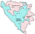
Bih dayton en.png 1,103 × 1,044; 65 KB
-
Bih dayton sh.png 1,103 × 1,044; 65 KB
-
Bih dayton sr.png 1,103 × 1,044; 65 KB
-
Carrington-Cutileiro plan.PNG 1,809 × 1,752; 106 KB
-
Connecting BiH Croat area and enclaves.png 2,500 × 1,752; 175 KB
-
Dayton.png 1,809 × 1,752; 171 KB
-
Joint cantonisation proposal of HDZ-SDA of August 1992.png 1,809 × 1,752; 103 KB
-
Later carrington cutillero.png 1,770 × 1,678; 116 KB
-
Oven stoltenberg.png 1,809 × 1,752; 150 KB
-
Postdayton.png 1,809 × 1,752; 157 KB
-
Prije daytona.JPG 1,213 × 1,100; 200 KB
-
The first Muslim proposal on cantonisation of Bosnia and Herzegovina.png 1,770 × 1,678; 84 KB
-
Treći entitet.png 1,220 × 1,100; 123 KB
-
Vance-Owen Peace Plan.png 1,220 × 1,100; 103 KB
-
Vance-owen plan.png 572 × 508; 36 KB


