Category:Maps of proposed territories
Jump to navigation
Jump to search
Subcategories
This category has the following 14 subcategories, out of 14 total.
Media in category "Maps of proposed territories"
The following 25 files are in this category, out of 25 total.
-
Alternative divisions of Belarus.png 3,827 × 3,218; 764 KB
-
Alternative subdivisions of Jacvieź.png 2,305 × 3,190; 189 KB
-
Bahçeşehir İlçesi.jpg 3,522 × 2,066; 665 KB
-
Distrikt Bosanska Posavina.png 1,055 × 514; 39 KB
-
Karta-RRRUS, Русской Республики РУСЬ.jpg 800 × 554; 121 KB
-
Location of Peconic County.svg 776 × 343; 106 KB
-
Mapa de Bolivia (nuevos departamentos propuestos).svg 2,218 × 2,215; 634 KB
-
Moldavian irredentist proposals, 1943 and 1946.svg 2,997 × 2,346; 176 KB
-
Northern Caucasus regions map (it).png 690 × 397; 147 KB
-
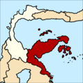
Peta Provinsi Sulawesi Timur.png 768 × 768; 137 KB
-
Pind-Meglen.png 200 × 204; 23 KB
-
Rojava cities.png 1,124 × 519; 40 KB
-
Rojava february2014.png 1,124 × 569; 54 KB
-
Rojava februar 2014.png 1,152 × 648; 44 KB
-
Rojava march 2016.png 800 × 405; 110 KB
-
Sabor u baji 1694 01.png 1,354 × 877; 74 KB
-
Sabor u baji 1694 02.png 1,354 × 877; 76 KB
-
Sabor u krusedolu 1708 01.png 1,354 × 877; 69 KB
-
Sabor u krusedolu 1708 02.png 1,354 × 877; 69 KB
-
Southern and western kurdistan.png 977 × 670; 47 KB
-
Tabarnia.jpg 819 × 722; 77 KB
-
Temisvarski sabor 1790 01.png 996 × 704; 84 KB
-
Temisvarski sabor 1790 02.png 996 × 704; 69 KB
-
Uhro-Rusinia map.jpg 1,846 × 806; 1.09 MB
-
Srpska Vojvodina 1848. i današnji ZVO.png 621 × 504; 23 KB


