Category:Maps of the history of modern Slovenia
Jump to navigation
Jump to search
Slovenščina: Zemljevidi zgodovine sodobne Slovenije.
Subcategories
This category has the following 7 subcategories, out of 7 total.
M
W
Y
Media in category "Maps of the history of modern Slovenia"
The following 18 files are in this category, out of 18 total.
-
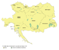
Greater austria.png 1,500 × 1,280; 45 KB
-
Vereinigte Staaten von Groß-Österreich hu.png 938 × 800; 149 KB
-
Vereinigte Staaten von Groß-Österreich.png 1,500 × 1,280; 192 KB
-
대 오스트리아.png 1,500 × 1,280; 64 KB
-
Greater austriaPL.png 1,500 × 1,280; 74 KB
-
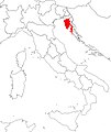
Italian province of fiume.JPG 764 × 904; 64 KB
-
Italian province of Pola.JPG 764 × 904; 64 KB
-
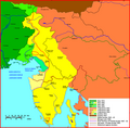
Litorale 1.png 2,264 × 2,221; 203 KB
-
Litorale 3.png 744 × 972; 74 KB
-
NavodniSporazumPavelicStojadinovicDetalji.png 1,000 × 824; 116 KB
-
Radgonski kot.jpg 337 × 340; 41 KB
-
Slovenian war map (cropped).jpg 4,216 × 2,482; 7.09 MB
-
Slovenian war map.jpg 5,000 × 3,226; 9.97 MB
-
Sporazum Pavelic-Stojadinovic.png 1,000 × 824; 63 KB
-
SporazumPavelicStojadinovic.png 1,000 × 824; 74 KB
-
Yugoslavia proposed banovinas 1939 1941-sr.png 1,051 × 929; 70 KB
-
Yugoslavia proposed banovinas 1939 1941.png 1,051 × 929; 72 KB
-
Zemljevid občin v mariborski oblasti.jpg 2,001 × 1,078; 393 KB


