Category:Maps of the history of modern Romania
Jump to navigation
Jump to search
Subcategories
This category has the following 5 subcategories, out of 5 total.
Media in category "Maps of the history of modern Romania"
The following 98 files are in this category, out of 98 total.
-
176 of 'Cassell's Illustrated History of the Russo-Turkish War' (11238912126).jpg 2,026 × 2,966; 1.37 MB
-
United Principalities, 1861, with counties - bel labels.svg 666 × 535; 55 KB
-
United Principalities, 1861, with counties.svg 666 × 535; 52 KB
-
194791.png 587 × 413; 28 KB
-
Administrative map of Romania, 1950-1952.svg 1,650 × 1,250; 2.05 MB
-
Administrative map of Romania, 1952-1956.png 1,400 × 1,001; 338 KB
-
Administrative Map of Romania, 1956.png 3,520 × 2,844; 819 KB
-
Administrative map of Romania, 1960-1968.jpg 6,438 × 5,100; 5.22 MB
-
Administrative map of Romania, 1960-1968.svg 1,650 × 1,250; 3.02 MB
-
AtlBalk1880.jpg 318 × 327; 153 KB
-
AtlBalk1945-90.jpg 318 × 327; 168 KB
-
Balkans1878 -1912.jpg 559 × 600; 316 KB
-
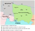
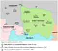
Banat Republic bgiu.png 656 × 570; 138 KB
-
Banat Republic bgiu2.png 656 × 570; 145 KB
-
Banat republic hu.png 1,000 × 886; 119 KB
-
Banat republic-es.svg 5,275 × 3,689; 642 KB
-
Banat republic-sr.png 1,000 × 886; 72 KB
-
Banat republic.png 1,000 × 886; 80 KB
-
Banatia hu.svg 1,333 × 1,033; 67 KB
-
Banatia-sr.png 1,000 × 775; 62 KB
-
Banatia.png 1,000 × 775; 74 KB
-
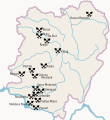
Bufeni settlements in Caraș-Severin.svg 2,103 × 2,290; 235 KB
-
Bulgaria after Congress of Berlin in 1878.png 4,148 × 2,896; 552 KB
-
Constantinople conference.png 3,741 × 2,612; 505 KB
-
Csango and Székely settlements in the United Principalities, 1861.svg 9,632 × 7,971; 351 KB
-
Danube-Kris-Mures-Tisa Euroregion map.png 824 × 970; 78 KB
-
DKMTEuroregion.png 1,190 × 1,290; 317 KB
-
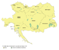
Greater austria.png 1,500 × 1,280; 45 KB
-
Vereinigte Staaten von Groß-Österreich hu.png 938 × 800; 149 KB
-
Vereinigte Staaten von Groß-Österreich.png 1,500 × 1,280; 192 KB
-
대 오스트리아.png 1,500 × 1,280; 64 KB
-
Greater austriaPL.png 1,500 × 1,280; 74 KB
-
Harta lingvistica a Ungariei de Est in 1910 hu.png 2,086 × 1,963; 1.03 MB
-
Harta lingvistica a Ungariei de Est in 1910.png 1,521 × 1,431; 564 KB
-
Harta RPR Regiuni1952.jpg 2,902 × 2,044; 3.23 MB
-
Heraldic fragment of Tabula Valachiæ Cis-alutanæ, 1723.png 1,274 × 718; 1.74 MB
-
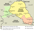
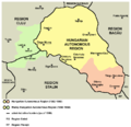
Hungarian autonomous province01.png 443 × 371; 5 KB
-
Hungarian autonomous province02 (hun).svg 710 × 647; 73 KB
-
Hungarian autonomous province02.png 751 × 727; 60 KB
-
Magyar Autonomous Region.png 619 × 599; 103 KB
-
JudeteAntebelice.png 1,000 × 702; 200 KB
-
Kingdom of Hungary counties (sk-Aradská).svg 1,772 × 1,166; 314 KB
-
Kingdom of Hungary counties (sk-Bihárska).svg 1,772 × 1,166; 314 KB
-
Kingdom of Hungary counties (sk-Brašovská).svg 1,772 × 1,166; 1.21 MB
-
Kingdom of Hungary counties (sk-Bystricko-nasodská).svg 1,772 × 1,166; 1.21 MB
-
Kingdom of Hungary counties (sk-Dolnobelehradská).svg 1,772 × 1,166; 314 KB
-
Kingdom of Hungary counties (sk-Fogarašská).svg 1,772 × 1,166; 315 KB
-
Kingdom of Hungary counties (sk-Huňadská).svg 1,772 × 1,166; 1.21 MB
-
Kingdom of Hungary counties (sk-Háromsecká).svg 1,772 × 1,166; 1.21 MB
-
Kingdom of Hungary counties (sk-Klužská).svg 1,772 × 1,166; 314 KB
-
Kingdom of Hungary counties (sk-Krasovsko-severinská).svg 1,772 × 1,166; 2.36 MB
-
Kingdom of Hungary counties (sk-Malokykulská).svg 1,772 × 1,166; 1.21 MB
-
Kingdom of Hungary counties (sk-Marmarošská).svg 1,772 × 1,166; 1.21 MB
-
Kingdom of Hungary counties (sk-Marušsko-turdská).svg 1,772 × 1,166; 315 KB
-
Kingdom of Hungary counties (sk-Čanadská).svg 1,772 × 1,166; 314 KB
-
Kingdom of Hungary counties (sk-Čická).svg 1,772 × 1,166; 1.21 MB
-
Kirchenprovinz Kalocsa 1909.jpg 1,491 × 898; 266 KB
-
KuK Nichtunierte.jpg 1,465 × 1,497; 1.29 MB
-
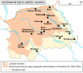
Map of cities in Suceava County and Southern Bukovina.svg 900 × 790; 418 KB
-
MAT.gif 800 × 564; 38 KB
-
Mediæval and modern history (1920) (14773848065).jpg 2,208 × 1,452; 771 KB
-
Moldawien BV043420615.jpg 1,493 × 2,424; 270 KB
-
Northern Transylvania ethnic map.svg 400 × 420; 698 KB
-
Németek Erdélyben.svg 695 × 568; 93 KB
-
Ottoman invasion of Wallachia, 1821-es.svg 1,493 × 1,000; 1.79 MB
-
Ottoman invasion of Wallachia, 1821.svg 960 × 643; 2.04 MB
-
PhilatelicmapRomania.jpg 800 × 572; 236 KB
-
R.S.R., hartă administrativă, 1966.jpeg 2,263 × 1,591; 1.17 MB
-
Repressive system Romania+Moldova 1946-1989.jpg 587 × 413; 328 KB
-
Results of the Treaty of Berlin 1878..jpg 5,120 × 7,352; 11.92 MB
-
Romania - Division territòriala vèrs 1750.png 1,011 × 826; 158 KB
-
Romania - Principats de Valaquia e de Moldàvia en 1815.png 1,012 × 826; 153 KB
-
Romania - Romania en 1878.png 1,012 × 826; 160 KB
-
Romania - Romania en 1925.png 1,131 × 922; 180 KB
-
Romania - Romania en 1940.png 1,131 × 922; 178 KB
-
Romania 1859-1878.jpg 588 × 413; 196 KB
-
Romania 1859-1913 blue.png 1,168 × 880; 75 KB
-
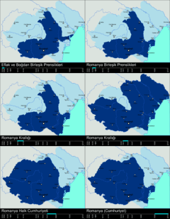
Romania 1859-2006.PNG 408 × 318; 31 KB
-
Romania 2000.png 587 × 413; 29 KB
-
Romania administrative divisions, 1864.svg 1,042 × 801; 400 KB
-
Romania Judete Antebelice (RO).svg 2,500 × 2,200; 1.06 MB
-
Romania Judete Antebelice es.svg 2,500 × 2,200; 1.8 MB
-
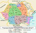
Romania Judeţe 1940-2010.jpg 789 × 721; 597 KB
-
Romania territory during 20th century.gif 538 × 398; 28 KB
-
Romania's Resistance 1948-1960.svg 1,052 × 744; 175 KB
-
RomaniaBorderHistoryAnnimation 1859-2010 tr.gif 1,000 × 861; 166 KB
-
RomaniaLosses1878.jpg 588 × 413; 189 KB
-
Russian map of a battle in Focşani.jpg 775 × 1,339; 161 KB
-
Russian map of a battle in Râmnicu Sărat, 1789-09-11.jpg 1,449 × 1,149; 270 KB
-
Russian map of Russo-Turkish War 1807-06-02 in Romania.jpg 922 × 1,277; 164 KB
-
Salt trade in Wallachia (16th–19th centuries).svg 1,003 × 759; 1.87 MB
-
SanStefanoBalkan.jpg 1,112 × 857; 410 KB
-
Sanstefanska Bulgaria.png 3,791 × 2,647; 1.9 MB
-
Szeben county map.jpg 2,100 × 1,653; 381 KB
-
Vladimirescu's uprising, 1821-es.svg 1,253 × 1,000; 1.53 MB
-
Vladimirescu's uprising, 1821.svg 804 × 643; 1.68 MB
-
Wallachia voting share, 1857.svg 800 × 406; 266 KB


