Category:Maps of the history of Delhi
Jump to navigation
Jump to search
States of India: Andhra Pradesh · Assam · Goa · Himachal Pradesh · Karnataka · Kerala · Maharashtra · Tamil Nadu · Telangana · West Bengal
Union territories: Dadra and Nagar Haveli and Daman and Diu · Delhi · Jammu and Kashmir · Ladakh · Puducherry
Former states of India:
Former union territories:
Union territories: Dadra and Nagar Haveli and Daman and Diu · Delhi · Jammu and Kashmir · Ladakh · Puducherry
Former states of India:
Former union territories:
Media in category "Maps of the history of Delhi"
The following 17 files are in this category, out of 17 total.
-
2005 October 29 New Delhi Bomb blasts map.png 1,699 × 2,800; 3.28 MB
-
Delhi 2008 blasts 2.svg 960 × 725; 471 KB
-
Delhi 2008 blasts final.svg 397 × 416; 527 KB
-
Delhi map.PNG 428 × 433; 10 KB
-
Delhi Metro Phase 2 Route Map.svg 859 × 802; 207 KB
-
Delhi Metro Phase 2 Schematic Route Map.svg 691 × 565; 145 KB
-
Delhi Municipalities Cantt.svg 600 × 600; 54 KB
-
Delhi Municipalities East.svg 600 × 600; 54 KB
-
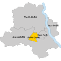
Delhi Municipalities New.svg 600 × 600; 54 KB
-
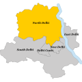
Delhi Municipalities North.svg 600 × 600; 54 KB
-
Delhi Municipalities South.svg 600 × 600; 54 KB
-
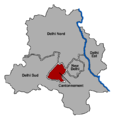
DelhiMunicipalitésCantt.png 648 × 676; 29 KB
-
DelhiMunicipalitésEst.png 648 × 676; 31 KB
-
DelhiMunicipalitésNew.png 648 × 676; 31 KB
-
DelhiMunicipalitésNord.png 648 × 676; 31 KB
-
DelhiMunicipalitésSud.png 648 × 676; 30 KB
-
NEW DELHI (Nowe Delhi).png 1,296 × 1,352; 337 KB


