Category:Maps of the history of Assam
Jump to navigation
Jump to search
States of India: Andhra Pradesh · Assam · Goa · Himachal Pradesh · Karnataka · Kerala · Maharashtra · Tamil Nadu · Telangana · West Bengal
Union territories: Dadra and Nagar Haveli and Daman and Diu · Delhi · Jammu and Kashmir · Ladakh · Puducherry
Former states of India:
Former union territories:
Union territories: Dadra and Nagar Haveli and Daman and Diu · Delhi · Jammu and Kashmir · Ladakh · Puducherry
Former states of India:
Former union territories:
Subcategories
This category has the following 2 subcategories, out of 2 total.
K
M
- Maps of the Ahom Kingdom (5 F)
Media in category "Maps of the history of Assam"
The following 36 files are in this category, out of 36 total.
-
Assam 1950-hu.svg 703 × 655; 76 KB
-
Assam 1950.svg 703 × 655; 77 KB
-
Assam 1951 as.svg 606 × 615; 1.16 MB
-
Assam 1951 ml.svg 606 × 615; 1.18 MB
-
Assam 1951-bn.svg 606 × 615; 1.18 MB
-
Assam 1951-gu.svg 606 × 615; 1.12 MB
-
Assam 1951-hi.svg 606 × 615; 1.16 MB
-
Assam 1951-kn.svg 568 × 577; 1.18 MB
-
Assam 1951-mr.svg 606 × 615; 1.16 MB
-
Assam 1951-pa.svg 606 × 615; 1.1 MB
-
Assam 1951-te.svg 606 × 615; 1.16 MB
-
Assam 1951.svg 606 × 615; 2.25 MB
-
Assam 1970.svg 606 × 615; 2.98 MB
-
Assam in 1950s-ar.png 720 × 960; 71 KB
-
Assam in 1950s.png 720 × 960; 44 KB
-
Autonome Distrikte Assam.svg 1,005 × 660; 396 KB
-
Battle of saraighat as.svg 626 × 320; 25 KB
-
Battle of saraighat.svg 626 × 320; 25 KB
-
Bodoland Territorial Area Districts as.svg 1,005 × 660; 400 KB
-
Bodoland Territorial Area Districts.svg 1,005 × 660; 400 KB
-
Chutia kingdom Map.png 1,233 × 573; 786 KB
-
Dima Hasao und Karbi Anglong Distrikte.svg 1,005 × 660; 416 KB
-
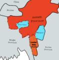
Lushai Hills Map 1938.png 720 × 734; 280 KB
-
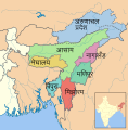
SevenSisterStates as.svg 606 × 615; 1.05 MB
-
SevenSisterStates-bh.svg 606 × 615; 1.05 MB
-
SevenSisterStates-gu.svg 606 × 615; 1 MB
-
SevenSisterStates-hi.svg 606 × 615; 1.05 MB
-
SevenSisterStates-kn.svg 606 × 615; 1.05 MB
-
SevenSisterStates-ml.svg 606 × 615; 1.05 MB
-
SevenSisterStates-mr.svg 606 × 615; 1.05 MB
-
SevenSisterStates-ne.svg 606 × 615; 1.05 MB
-
SevenSisterStates-te.svg 606 × 615; 1.05 MB
-
SevenSisterStates.svg 606 × 615; 1 MB
-
Sutiya Kingdom Map.jpg 444 × 451; 164 KB
-
Tibetan empire greatest extent 780s-790s CE.png 1,792 × 1,361; 4.55 MB
-
শৰাইঘাটৰ যুদ্ধ, মাৰ্চ ১৬৭১.png 626 × 320; 31 KB


