Category:Maps of the history of Canada
Jump to navigation
Jump to search
former political entities in what is now Canada | |||||
| Upload media | |||||
| Facet of | |||||
|---|---|---|---|---|---|
| Location |
| ||||
| |||||
Subcategories
This category has the following 12 subcategories, out of 12 total.
Media in category "Maps of the history of Canada"
The following 177 files are in this category, out of 177 total.
-
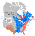
Neufrankreich.svg 1,530 × 1,090; 694 KB
-
180 of 'The History of Canada' (11195602836).jpg 2,432 × 1,535; 780 KB
-
1903 Alaska boundary dispute.png 538 × 538; 16 KB
-
1926 Canada-Alaska 1903 boundary-map.jpg 448 × 432; 55 KB
-
1926 Canada-Alaska 1903 boundary-map.png 429 × 418; 433 KB
-
1voyageJacquesCartier.jpg 608 × 636; 81 KB
-
20 of 'The Old Régime in Canada (1653-1763) ... Fourteenth edition' (11181188004).jpg 2,826 × 2,197; 865 KB
-
2ndcdndivwwiieurmap.gif 468 × 371; 11 KB
-
A Plan of the route from Halifax to River du Loup on the St. Lawrence.png 1,269 × 2,653; 6.97 MB
-
Alaska boundary dispute.jpg 1,184 × 1,096; 438 KB
-
Anglo American War 1812 Locations map-ar.svg 1,052 × 744; 1.02 MB
-
Anglo American War 1812 Locations map-en he.svg 1,503 × 836; 439 KB
-
Anglo American War 1812 Locations map-en.svg 1,052 × 744; 136 KB
-
Anglo American War 1812 Locations map-es.svg 1,494 × 830; 127 KB
-
Anglo American War 1812 Locations map-fr.svg 1,494 × 830; 206 KB
-
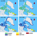
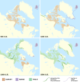
Arctic cultures 900-1500 (no caption).png 259 × 917; 209 KB
-
Arctic cultures 900-1500 (square).png 527 × 510; 223 KB
-
Arctic cultures 900-1500.png 259 × 989; 251 KB
-
Basques Newfoundland.gif 665 × 522; 15 KB
-
Britisches Nord-America (12796647275).jpg 2,470 × 2,000; 1.85 MB
-
British America.png 383 × 329; 11 KB
-
British colonies 1763-76 shepherd1923.jpg 1,651 × 1,010; 625 KB
-
British colonies 1763-76 shepherd1923.PNG 1,651 × 1,010; 3.57 MB
-
British colonies in North America (13997468724).jpg 1,553 × 2,000; 1.32 MB
-
British colonies, in North America from the best authorities (14017028493).jpg 2,445 × 2,000; 2.18 MB
-
British dominions, in North America (13149900243).jpg 2,500 × 1,977; 2.15 MB
-
British North America (12973239563).jpg 2,426 × 2,000; 2.12 MB
-
British North America (13149900843).jpg 2,500 × 1,985; 2.23 MB
-
British North America (13407301623).jpg 2,500 × 1,974; 2 MB
-
British North America (14017027783).jpg 2,449 × 2,000; 2.07 MB
-
British North America (14168300682).jpg 2,500 × 1,983; 2.35 MB
-
British possessions in America (13407180395).jpg 2,500 × 1,971; 1.67 MB
-
British possessions in North America (12797057864).jpg 2,500 × 1,831; 1.68 MB
-
British possessions in North America (14166789160).jpg 2,500 × 1,668; 1.98 MB
-
British possessions in North America (14236338202).jpg 2,500 × 1,579; 1.89 MB
-
Canada 1867.svg 360 × 293; 67 KB
-
Canada provinces evolution de.gif 1,000 × 864; 249 KB
-
Canada provinces evolution frame.png 1,000 × 864; 43 KB
-
Canada Provinces Territories 1870.png 280 × 230; 20 KB
-
Canada Provinces Territories 1905.png 280 × 230; 20 KB
-
Canada Provinces Territories 1949.png 280 × 230; 20 KB
-
Canada-1882.png 694 × 600; 198 KB
-
Canada-1895.png 1,000 × 864; 73 KB
-
Canoe River train crash.svg 550 × 545; 76 KB
-
Carte de la baie des Chaleurs a la cote Occidentale du golfe de St. Laurent.jpg 2,472 × 3,496; 1.97 MB
-
Carte de la Baye de Hudson, pour servir a l'histoire général des voyages (14457952933).jpg 2,500 × 1,835; 2.39 MB
-
Carte Guerre de 7 ans Amérique du nord.PNG 1,120 × 853; 92 KB
-
Carte Guerre de 7 ans Amérique du nord2.PNG 1,120 × 853; 104 KB
-
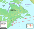
Cartier First Voyage Map 1 fr.png 636 × 552; 47 KB
-
Cartier First Voyage Map 1.png 636 × 552; 55 KB
-
Cartier Second Voyage Map 1 fr.png 831 × 567; 91 KB
-
Cartier Second Voyage Map 1.png 831 × 567; 103 KB
-
Count Frontenac and New France under Louis XIV BHL21318159.jpg 3,115 × 2,403; 726 KB
-
De Mi'kmaq.png 2,360 × 1,650; 996 KB
-
Die Akadier.png 1,180 × 824; 367 KB
-
District-Ungava-1898.png 280 × 230; 14 KB
-
Dorset, Norse, and Thule cultures 900-1500 (vertical)-01.svg 512 × 2,076; 424 KB
-
Dorset, Norse, and Thule cultures 900-1500.svg 512 × 525; 445 KB
-
Els Acadians.png 1,180 × 824; 435 KB
-
Els Micmac.png 2,360 × 1,650; 985 KB
-
FormerNWTcapitals.png 411 × 359; 65 KB
-
Fort-Beausejour en.png 1,180 × 825; 554 KB
-
Fort-Beausejour fr.png 1,180 × 825; 564 KB
-
Franklin Last Expedition Map.jpg 597 × 510; 98 KB
-
Franklin's lost expedition map ru.png 602 × 522; 42 KB
-
Franklin's lost expedition map.png 602 × 520; 121 KB
-
French possessions in the Americas (1534-1803).png 2,000 × 2,000; 644 KB
-
Henry Hudson Map 26.png 824 × 709; 499 KB
-
Huronie.JPG 900 × 674; 132 KB
-
I Mi'kmaq.png 2,360 × 1,650; 1,002 KB
-
IsleRoyaleAgreement.jpg 1,100 × 800; 567 KB
-
Jaques-cartier-1-bidaia-eus.svg 512 × 298; 1.14 MB
-
Jaques-cartier-2-bidaia-eus.svg 512 × 298; 1.14 MB
-
Keewatin1876.png 1,000 × 864; 54 KB
-
Klondike Routes Map.png 644 × 769; 361 KB
-
Klondike Routes Map.svg 636 × 676; 1.02 MB
-
La Vérendrye Map.jpg 1,024 × 364; 70 KB
-
Les Micmacs (multilingual).svg 3,387 × 2,113; 455 KB
-
Les Micmacs.png 2,360 × 1,650; 1,007 KB
-
Long Gull Pond.jpg 2,850 × 1,900; 3.54 MB
-
Los Acadianos.png 1,180 × 824; 441 KB
-
Los Micmac.png 2,360 × 1,650; 996 KB
-
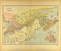
Map of Eastern Canada.jpg 3,479 × 2,928; 2.41 MB
-
Map1775.jpg 1,028 × 696; 128 KB
-
Map1776.jpg 1,028 × 696; 141 KB
-
Map1777b.jpg 1,028 × 696; 148 KB
-
Map1778b.jpg 1,028 × 696; 133 KB
-
Map1779b.jpg 1,028 × 696; 135 KB
-
Map1780b.jpg 1,028 × 696; 142 KB
-
Map1781b.jpg 1,028 × 696; 138 KB
-
Maritime Fur Trade-NorthWestCoast.png 1,173 × 819; 208 KB
-
Mikmaq-Stammesgebiet.png 2,360 × 1,650; 1,001 KB
-
Modern and contemporary European history (1815-1921) (1922) (14597706830).jpg 2,800 × 1,630; 693 KB
-
Montreal GareCentrale NouvelleLigneThornton.gif 1,000 × 466; 61 KB
-
N FR.JPG 751 × 408; 16 KB
-
N-France.png 1,357 × 628; 36 KB
-
Native Map Seventeen Rivers beyond Churchill 1719 (1969).jpg 2,604 × 3,478; 1.39 MB
-
NBC Networks Feb 1933.jpg 2,000 × 1,183; 563 KB
-
New France (orthographic projection).svg 550 × 550; 580 KB
-
New France.jpg 1,097 × 769; 34 KB
-
New-France1750.png 1,440 × 1,465; 157 KB
-
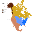
Non-Native American Nations Control over N America 1750-2008.gif 700 × 783; 537 KB
-
Non-Native American Nations Control over N America 1800.png 800 × 895; 196 KB
-
Non-Native Nations Claim over NAFTA countries 1750.png 800 × 895; 104 KB
-
Non-Native Nations Claim over NAFTA countries 1759.png 800 × 895; 105 KB
-
Non-Native Nations Claim over NAFTA countries 1763.png 800 × 895; 148 KB
-
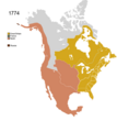
Non-Native Nations Claim over NAFTA countries 1774.png 800 × 895; 141 KB
-
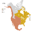
Non-Native Nations Claim over NAFTA countries 1778.png 800 × 895; 145 KB
-
Non-Native Nations Claim over NAFTA countries 1783.png 800 × 895; 151 KB
-
Non-Native Nations Claim over NAFTA countries 1784.png 800 × 895; 147 KB
-
Non-Native Nations Claim over NAFTA countries 1790 (cropped).png 101 × 101; 10 KB
-
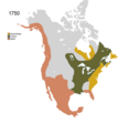
Non-Native Nations Claim over NAFTA countries 1790.png 800 × 895; 158 KB
-
Non-Native Nations Claim over NAFTA countries 1791.png 800 × 895; 161 KB
-
Non-Native Nations Claim over NAFTA countries 1792.png 800 × 895; 161 KB
-
Non-Native Nations Claim over NAFTA countries 1796.png 800 × 895; 158 KB
-
Non-Native Nations Claim over NAFTA countries 1798.png 800 × 895; 159 KB
-
Non-Native Nations Claim over NAFTA countries 1799.png 800 × 895; 171 KB
-
Non-Native Nations Claim over NAFTA countries 1802.png 800 × 895; 175 KB
-
Non-Native Nations Claim over NAFTA countries 1803.png 800 × 895; 177 KB
-
Non-Native Nations Claim over NAFTA countries 1805.png 800 × 895; 178 KB
-
Non-Native Nations Claim over NAFTA countries 1810.png 800 × 895; 180 KB
-
Non-Native Nations Claim over NAFTA countries 1812.png 800 × 895; 180 KB
-
Non-Native Nations Claim over NAFTA countries 1816.png 800 × 895; 179 KB
-
Non-Native Nations Claim over NAFTA countries 1817.png 800 × 895; 180 KB
-
Non-Native Nations Claim over NAFTA countries 1818.png 800 × 895; 178 KB
-
Non-Native Nations Claim over NAFTA countries 1819.png 800 × 895; 179 KB
-
Non-Native Nations Claim over NAFTA countries 1820.png 800 × 895; 179 KB
-
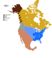
Non-Native Nations Claim over NAFTA countries 1821.png 800 × 895; 173 KB
-
Non-Native Nations Claim over NAFTA countries 1824.png 800 × 895; 206 KB
-
NorthAmerica1762-83-ar.png 787 × 600; 114 KB
-
NorthAmerica1762-83.png 787 × 600; 90 KB
-
Northwest Territories Regions pre 1999.png 671 × 549; 112 KB
-
Nouvelle-France map-ar.svg 1,530 × 1,090; 560 KB
-
Nouvelle-France map-ca.svg 1,530 × 1,090; 374 KB
-
Nouvelle-France map-en.svg 1,530 × 1,090; 586 KB
-
Nouvelle-France map-es.svg 1,530 × 1,090; 661 KB
-
Nouvelle-France map-fr it.svg 1,530 × 1,090; 326 KB
-
Nouvelle-France map-fr.svg 1,530 × 1,090; 375 KB
-
Nouvelle-France map-he.svg 1,530 × 1,090; 550 KB
-
Nouvelle-France map-ru.svg 1,574 × 1,091; 731 KB
-
Nouvelle-France map-sr.svg 1,530 × 1,090; 331 KB
-
Nouvelle-France map-zh-hans.svg 1,530 × 1,090; 231 KB
-
Nouvelle-France1750.jpg 1,795 × 1,744; 234 KB
-
Nouvelle-France1750.png 1,440 × 1,465; 89 KB
-
NouvelleFrance-Vraie-Version.png 1,530 × 1,090; 1.38 MB
-
Numbered-Treaties-Map.svg 1,005 × 690; 111 KB
-
NutcaEN.png 1,103 × 931; 229 KB
-
Ontario Métis Community Councils map.jpg 1,056 × 816; 648 KB
-
Peninsule acadienne (multilingue).svg 1,180 × 825; 1.21 MB
-
Red River Trails Locator Map cropped.PNG 435 × 530; 15 KB
-
Red-river-basin.png 540 × 397; 97 KB
-
Republic of Canada 1837.svg 550 × 550; 690 KB
-
Riviere de St Laurens depuys Montreal jusqu a Tadoussac - 1641.jpg 4,329 × 5,913; 4.82 MB
-
Shepherd - The British colonies in North America, 1763-1775 in Historical Atlas, 1911.xcf 1,896 × 1,348; 5.65 MB
-
SuperContinental RouteMap.png 864 × 369; 59 KB
-
The Mi'kmaq raw version.png 2,360 × 1,650; 772 KB
-
The Mi'kmaq.png 2,360 × 1,650; 985 KB
-
Treaty Shore of Newfoundland.png 869 × 1,016; 420 KB
-
Vinland-travel-hy.jpg 1,214 × 1,600; 488 KB
-
Vinland-travel.jpg 1,214 × 1,600; 369 KB
-
Wabanaki Confederacy (Anglicised Names).png 1,754 × 1,156; 601 KB
-
Wabanaki Confederacy (Native Names).png 1,754 × 1,156; 610 KB
-
Western Canadian Province Proposals.png 775 × 1,107; 531 KB
-
York-Factory-Express.png 876 × 593; 142 KB


