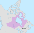
Category:Maps of Rupert's Land
Jump to navigation
Jump to search
Subcategories
This category has only the following subcategory.
Media in category "Maps of Rupert's Land"
The following 6 files are in this category, out of 6 total.
-
Hudson bay explorer.png 550 × 442; 449 KB
-
HudsonBay ruperts land.jpg 300 × 239; 31 KB
-
NorthAmerica1762-83.png 787 × 600; 90 KB
-
Ruperts land-es.svg 1,304 × 1,263; 128 KB
-
Ruperts land.svg 1,304 × 1,263; 119 KB
-
Wpdms ruperts land.jpg 600 × 478; 38 KB


