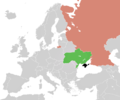
Category:Maps of the annexation of Crimea by the Russian Federation
Jump to navigation
Jump to search
Subcategories
This category has the following 3 subcategories, out of 3 total.
Media in category "Maps of the annexation of Crimea by the Russian Federation"
The following 21 files are in this category, out of 21 total.
-
2014 Russo-ukrainian-conflict map.svg 4,126 × 4,480; 2.75 MB
-
2014 Крим.PNG 2,336 × 1,552; 1.24 MB
-
Annexation of Crimea.png 682 × 509; 29 KB
-
Crimea crisis map (alternate color for Russia).PNG 1,200 × 1,000; 48 KB
-
Crimea crisis map.PNG 1,200 × 1,000; 61 KB
-
Crimean Federal District (numbered).svg 532 × 353; 110 KB
-
Crimean referendum 2014 (alternate colours).svg 532 × 353; 239 KB
-
Crimean referendum 2014 Voter turnout.png 1,867 × 1,231; 299 KB
-
Crimean referendum 2014.svg 532 × 353; 243 KB
-
Crimean referendum resolution vote.PNG 1,357 × 628; 48 KB
-
Flag map of Russia (+claims).svg 3,543 × 1,902; 118 KB
-
Flag map of Russia (2014–2022).svg 1,066 × 604; 73 KB
-
Flag map of Ukraine with Russian-occupied territories omitted.svg 1,283 × 866; 60 KB
-
Flag map of Ukraine, with Russian-occupied territory omitted.png 2,103 × 1,428; 62 KB
-
Location UK-Crimea-RU.PNG 1,200 × 1,000; 59 KB
-
Map of Russia. Crimean Federal District.svg 1,092 × 630; 95 KB
-
Prorussian 2008 2014.png 770 × 568; 138 KB
-
Flag map of Russia from 2014 to 2022.png 1,079 × 599; 29 KB
-
Flag map of Ukraine from January 2014.png 2,000 × 1,209; 40 KB
-
UN Resolution regarding the territorial integrity of Ukraine red.svg 940 × 415; 1.45 MB
-
Резолюция Генеральной Ассамблеи ООН о территориальной целостности Украины.png 6,704 × 3,000; 1.67 MB


