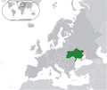
Category:Maps of disputed territories in Europe
Jump to navigation
Jump to search
Subcategories
This category has the following 7 subcategories, out of 7 total.
Media in category "Maps of disputed territories in Europe"
The following 40 files are in this category, out of 40 total.
-
A proposal map of Misak-ı Millî.jpg 1,571 × 1,600; 524 KB
-
Bay-of-Piran maritime-boundary-dispute-ar.png 2,000 × 1,863; 334 KB
-
Bay-of-Piran maritime-boundary-dispute.jpg 709 × 600; 160 KB
-
Chipre de facto-de iure.png 7,416 × 4,752; 686 KB
-
Contentieux frontalier du Morskie oko.png 830 × 649; 85 KB
-
Cyprus de facto-de iure-cs.png 16,535 × 10,630; 4.29 MB
-
DeltaPierderi.jpg 339 × 371; 172 KB
-
East Prussia 1923-1939.png 743 × 801; 23 KB
-
Europe-PPR.svg 2,045 × 1,720; 757 KB
-
Europe-Ukraine-Disputed.png 713 × 600; 111 KB
-
Gdansk Bay Borderlines 1939 blank.png 1,858 × 1,202; 29 KB
-
Gdansk Bay Borderlines 1939 English-colour.jpg 1,024 × 662; 172 KB
-
Gdansk Bay Borderlines 1939 English.png 1,858 × 1,202; 35 KB
-
Gdansk Bay Borderlines 1939 German.png 1,858 × 1,202; 35 KB
-
Gdansk Bay Borderlines 1939 greek.png 1,339 × 866; 93 KB
-
Gdansk Bay Borderlines 1939 Polish.png 1,858 × 1,202; 36 KB
-
Greater Serbia in Yugoslavia.png 1,504 × 1,163; 59 KB
-
Gulf of Piran sat borders.png 990 × 610; 875 KB
-
Hrebecsko 1880.gif 886 × 589; 185 KB
-
Hřebečsko 1910.png 1,031 × 650; 60 KB
-
Kartaferaios.png 500 × 381; 126 KB
-
Litorale 3.png 744 × 972; 74 KB
-
Memelland 1923-1939.png 733 × 560; 16 KB
-
Misak-i milli tr.png 1,474 × 909; 170 KB
-
Misak-i milli.png 1,474 × 909; 204 KB
-
Misak-ı Millî (fictitious).png 471 × 272; 41 KB
-
Novorossiya, areas under full and partial control.jpg 814 × 1,074; 145 KB
-
Oberschlesien 1921 Voten.png 411 × 323; 13 KB
-
Oberschlesien 1921.png 411 × 323; 13 KB
-
Ostbelgien2.png 394 × 788; 26 KB
-
Pas neutralny PL-LT i okupacja łotewska.PNG 559 × 512; 16 KB
-
Roszczenia litewskie.PNG 977 × 797; 53 KB
-
Servia1350AD.png 500 × 400; 37 KB
-
Spór o Morskie Oko.PNG 830 × 649; 22 KB
-
Vicinity-of-Prevlaka-in-Croatia-and-Montenegro hu.png 1,648 × 1,269; 626 KB
-
Vicinity-of-Prevlaka-in-Croatia-and-Montenegro.PNG 1,236 × 952; 80 KB
-
Спорные территории Калмыкии и Астраханской области.JPG 805 × 723; 108 KB
-
Տարածքային վեճերը Եվրոպայում (2015).png 1,984 × 1,736; 194 KB
-
유고슬라비아 내 대세르비아.png 1,504 × 1,163; 75 KB


