Category:Maps of the Socialist Republic of Serbia
Jump to navigation
Jump to search
Subcategories
This category has only the following subcategory.
K
Media in category "Maps of the Socialist Republic of Serbia"
The following 17 files are in this category, out of 17 total.
-
AdminSRB49.PNG 2,085 × 2,611; 364 KB
-
AdminSRB74.PNG 1,837 × 1,847; 124 KB
-
AdminSRB75.PNG 1,837 × 1,847; 119 KB
-
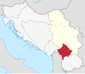
Locator map Kosovo in Yugoslavia and Serbia.svg 1,220 × 1,057; 461 KB
-
Locator map Kosovo in Yugoslavia.svg 1,220 × 1,057; 461 KB
-
Locator map Serbia in Yugoslavia.svg 1,220 × 1,057; 435 KB
-
Locator map Vojvodina in Yugoslavia and Serbia.svg 1,220 × 1,057; 461 KB
-
Locator map Vojvodina in Yugoslavia.svg 1,220 × 1,057; 461 KB
-
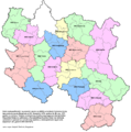
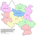
Medjuopcinske regionalne zajednice Socijalisticke Republike Srbije.png 740 × 1,059; 39 KB
-
Medjuopstinske regionalne zajednice Socijalisticke Republike Srbije.png 740 × 1,059; 88 KB
-
Opštine1965.png 1,978 × 2,683; 977 KB
-
SAP Kosovo.png 941 × 824; 15 KB
-
SAP Vojvodina.png 941 × 824; 21 KB
-
SerbiaSocialista.svg 595 × 431; 120 KB
-
SFRY Serbia.png 941 × 824; 21 KB
-
SR Serbia and SR Macedonia in SFR Yugoslavia.png 941 × 824; 33 KB
-
Srbia in SFRJ.svg 595 × 431; 378 KB


