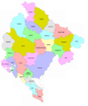
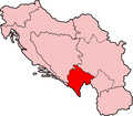
Category:Maps of the Socialist Republic of Montenegro
Jump to navigation
Jump to search
Media in category "Maps of the Socialist Republic of Montenegro"
The following 7 files are in this category, out of 7 total.
-
AdministrativnaCG52.PNG 3,000 × 3,000; 406 KB
-
AdministrativnaCG55.PNG 500 × 600; 104 KB
-
AdministrativnaCG57.PNG 2,500 × 3,000; 309 KB
-
Crnogorski kotarevi 1957.png 1,550 × 1,878; 151 KB
-
Locator map Montenegro in Yugoslavia.svg 1,220 × 1,057; 447 KB
-
SFRY Montenegro.png 941 × 824; 20 KB
-
SR Montenegro and SR Macedonia in SFR Yugoslavia.png 941 × 824; 33 KB


