Category:Maps of the Punjab region
Jump to navigation
Jump to search
Subcategories
This category has the following 4 subcategories, out of 4 total.
H
O
P
Media in category "Maps of the Punjab region"
The following 58 files are in this category, out of 58 total.
-

-
-
 Punjab map (topographic) ml.png 526 × 527; 171 KB
-
 Punjab map (topographic) no annotation.png 526 × 527; 186 KB
-
 British Punjab 1909.svg 1,000 × 1,000; 11.39 MB
-
 British Punjab before partition.tif 1,411 × 892; 567 KB
-
 Chamba Kangra Bilaspur Mandi Kulu 1911.jpeg 744 × 873; 130 KB
-
 Dialects Of Punjabi.jpg 682 × 624; 142 KB
-
 Dialects of punjabi.png 2,048 × 1,308; 2.8 MB
-
 Imperio Sij.JPG 800 × 655; 124 KB
-
 Ludhiana District 1911.png 534 × 493; 111 KB
-
 Map of Punjab.png 228 × 176; 9 KB
-
 Map of the Northern Part of the Punjab and of Kashmir (13305002).jpg 12,837 × 18,365; 111 MB
-

-

-
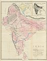
 North-Western India in 1946 map of India by National Geographic.jpg 2,185 × 1,813; 927 KB
-
 Penjab carte.jpg 300 × 214; 21 KB
-
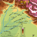
 Physical Map of Punjab.jpg 826 × 1,085; 208 KB
-
 Provincial Geographies of India Volume 1 0129.jpg 1,451 × 1,345; 442 KB
-
 Punjab (orthographic projection).svg 970 × 970; 13.19 MB
-
 Punjab (region) map in wikidata style.svg 1,772 × 1,513; 14 KB
-
 Punjab 88x59.png 88 × 59; 5 KB
-

-

-

-
 Punjab map (topographic) with cities.png 526 × 527; 181 KB
-
 Punjab map (topographic).png 526 × 527; 207 KB
-
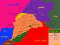
 Punjab map bn-simplified.svg 968 × 598; 230 KB
-
 Punjab map bn.svg 968 × 598; 255 KB
-
 Punjab map de.svg 955 × 585; 58 KB
-
 Punjab map gu.svg 968 × 598; 124 KB
-
 Punjab map hi.svg 968 × 598; 62 KB
-
 Punjab map pa.svg 968 × 598; 67 KB
-
 Punjab map ur.svg 3,979 × 2,437; 476 KB
-
 Punjab map-es.svg 1,019 × 624; 174 KB
-
 Punjab map.svg 955 × 585; 57 KB
-
 Punjab partition.png 1,350 × 863; 1.54 MB
-
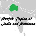
 Punjab region 1.jpg 564 × 565; 26 KB
-
 Punjab region 2.png 1,280 × 1,023; 514 KB
-
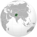
 Punjab region in Indian subcontinent.svg 512 × 519; 151 KB
-
 Punjab region Map.jpg 564 × 565; 59 KB
-
 Punjab region variation 1.svg 658 × 516; 13 KB
-
 Punjab region.png 1,280 × 1,023; 391 KB
-
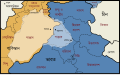
 Punjab region.svg 658 × 516; 13 KB
-
 Punjab-1863.jpg 2,340 × 1,700; 1.12 MB
-
 PunjabDoabs.png 1,583 × 1,135; 1.1 MB
-
 Punjabdoabs1.jpg 1,583 × 1,135; 268 KB
-
 Punjabis.PNG 154 × 158; 2 KB
-
 RangetsinghdiSultnat.png 960 × 720; 96 KB
-
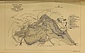
 Scinde Railway and the Punjaub.jpg 1,208 × 1,036; 240 KB
-
 Sikh Empire 1799-1849.svg 1,000 × 1,000; 16.89 MB
-
 Sikh Empire-ml.png 800 × 655; 239 KB
-
 Sikh Empire.JPG 800 × 655; 251 KB
-
 States of british punjab.png 1,166 × 884; 1.45 MB
-
 The Quarterly journal of the Geological Society of London (14154902110).jpg 2,000 × 1,247; 603 KB
-
 The Quarterly journal of the Geological Society of London, Volume XXXIV, Plate XIV.jpg 1,728 × 1,080; 540 KB
-
 Τοπογραφικός χάρτης του Παντζάμπ με πόλεις.png 526 × 527; 195 KB
-
 सिख साम्राज्य का मानचित्र.jpg 1,319 × 1,080; 428 KB
_(cropped).jpg)
.jpg)
_ml.png)
_no_annotation.png)


.jpg)
.jpg)


.svg)
_map_in_wikidata_style.svg)


_with_cities.png)
.png)


.jpg)


