Category:Maps of Punjab, Pakistan
Jump to navigation
Jump to search
Provinces of Pakistan: Balochistan · Khyber Pakhtunkhwa · Punjab · Sindh ·
Territories: Azad Kashmir · Gilgit-Baltistan · Islamabad Capital Territory ·
Territories: Azad Kashmir · Gilgit-Baltistan · Islamabad Capital Territory ·
Wikimedia category | |||||
| Upload media | |||||
| Instance of | |||||
|---|---|---|---|---|---|
| Category combines topics | |||||
| Punjab | |||||
province of Pakistan | |||||
| Instance of | |||||
| Part of | |||||
| Location | Pakistan | ||||
| Capital | |||||
| Legislative body |
| ||||
| Executive body |
| ||||
| Inception |
| ||||
| Population |
| ||||
| Area |
| ||||
| official website | |||||
 | |||||
Subcategories
This category has the following 8 subcategories, out of 8 total.
E
L
M
O
Pages in category "Maps of Punjab, Pakistan"
This category contains only the following page.
Media in category "Maps of Punjab, Pakistan"
The following 31 files are in this category, out of 31 total.
-
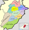
Administrative Divisions of Punjab.jpg 821 × 1,102; 310 KB
-
Base Map Chunian.gif 2,246 × 3,179; 639 KB
-
BlankMap-Punjab(Pak)2.PNG 864 × 1,102; 54 KB
-
British Punjab before partition.tif 1,411 × 892; 567 KB
-
Brwala map.jpg 1,600 × 1,600; 411 KB
-
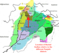
Buchal Kalan languages.png 782 × 712; 690 KB
-
Distribution of Pakistanis speaking Punjabi as a first language in 1998.png 2,720 × 2,450; 756 KB
-
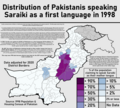
Distribution of Pakistanis speaking Saraiki as a first language in 1998.png 2,720 × 2,450; 761 KB
-
District-dialect-map-in-Punjab Province-of-Pakistan.png 1,006 × 634; 56 KB
-
Flag Map of Punjab Pakistan.png 1,691 × 2,018; 211 KB
-
Manawan Police Training School Lahore Map.jpg 1,871 × 1,487; 225 KB
-
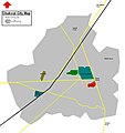
Map of Chakwal City.JPG 1,044 × 1,111; 64 KB
-
Map Upload.jpg 5,184 × 5,184; 3.43 MB
-
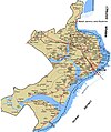
MapofJlm.JPG 1,285 × 1,535; 253 KB
-
New District wise map Punjab province 2022-Prepared by Vijay Kumar.jpg 29,535 × 30,720; 39.5 MB
-
Panjab 66.jpg 712 × 427; 56 KB
-
Phalia Map New By Tariq Imran 3rd.jpg 1,000 × 700; 484 KB
-
Physical Map of Punjab.jpg 826 × 1,085; 208 KB
-
Punjab (Pakistan) Divisions n.jpg 640 × 762; 83 KB
-
Punjab districts map.png 3,880 × 4,000; 1.92 MB
-
Punjab Districts.png 1,957 × 2,395; 166 KB
-
Punjab divisons map urdu.png 3,880 × 4,000; 1.97 MB
-
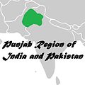
Punjab region 1.jpg 564 × 565; 26 KB
-
Punjab region Map.jpg 564 × 565; 59 KB
-
Punjab-Map.PNG 1,542 × 2,013; 851 KB
-
Punjab-Pakistan-Map1.jpg 437 × 537; 72 KB
-
PunjabDoabs.png 1,583 × 1,135; 1.1 MB
-
SERAIKI-SOUTH PUNJAB.jpg 581 × 430; 110 KB
-
Sukheke-Mandi.gif 600 × 371; 27 KB
-
Wagah-Attari (OpenStreetMap).png 940 × 600; 108 KB
-
قصور کے کوٹوں کا نقشہ.svg 512 × 521; 187 KB


