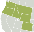
Category:Maps of the Northwestern United States
Jump to navigation
Jump to search
Subcategories
This category has only the following subcategory.
M
Media in category "Maps of the Northwestern United States"
The following 22 files are in this category, out of 22 total.
-
Nearctic-Northwestern United States.svg 1,789 × 2,154; 378 KB
-
Nearctic-Ecozone-Northwestern United States.svg 452 × 433; 25 KB
-
1872 North Cascades Isoseismal Map.png 1,464 × 1,544; 508 KB
-
Columbiarivermap.png 1,500 × 1,500; 3.6 MB
-
EPA WA-OR-ID snowpack map w text.png 633 × 863; 589 KB
-
EPA WA-OR-ID snowpack map.png 603 × 744; 524 KB
-
Inland Northwest United States.svg 280 × 280; 383 KB
-
Inland Northwest.svg 991 × 1,056; 464 KB
-
LLWS Northwest.svg 959 × 593; 105 KB
-
Map-USA-Pacific Northwest01.png 848 × 1,037; 149 KB
-
Map-USA-Pacific Northwest01.svg 744 × 1,052; 274 KB
-
Northwest Power and Conservation Council members.svg 959 × 593; 32 KB
-
Northwestern US Köppen.png 6,000 × 7,919; 679 KB
-
PacificNW volcanics.png 449 × 637; 25 KB
-
Rogue River-Siskiyou National Forest map.pdf 2,550 × 1,650; 30.35 MB
-
The Columbia River Its History, Its Myths, Its Scenery, Its Commerce p 595.png 1,775 × 945; 2.59 MB
-
The story of Montana (1916) (14771716244).jpg 3,152 × 2,276; 878 KB
-
US map-Northwest.PNG 572 × 371; 17 KB
-
US Northwest Temples Outline Map.svg 671 × 703; 17 KB
-
Voyage de La Pérouse autour du monde (No. 16) BHL15849654.jpg 6,832 × 9,696; 3.69 MB
-
Wyoming regions map.png 2,000 × 1,562; 855 KB
-
Wyoming regions map.svg 744 × 1,052; 7.68 MB


