Category:Maps of the New Forest
Jump to navigation
Jump to search
Media in category "Maps of the New Forest"
The following 14 files are in this category, out of 14 total.
-
98 of '(Our own country. Descriptive, historical, pictorial.)' (11175040514).jpg 1,730 × 1,691; 907 KB
-
EnglandNewForest.png 400 × 493; 58 KB
-
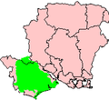
HampshireNewForestNationalPark.png 200 × 183; 4 KB
-
New Forest National Park map.svg 1,244 × 1,227; 925 KB
-
New Forest National Park UK location map.svg 1,244 × 1,227; 1.18 MB
-
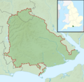
New Forest National Park UK relief location map.png 2,002 × 1,974; 1.29 MB
-
New Forest Tour map.png 658 × 621; 105 KB
-
Ordnance Survey Drawings - Christchurch Bay (OSD 75-1).jpg 4,000 × 3,458; 6.55 MB
-
Ordnance Survey One-Inch Sheet 179 Bournemouth, Published 1940.jpg 8,218 × 9,543; 10.36 MB
-
Ordnance Survey One-Inch Sheet 179 Bournemouth, Published 1966.jpg 8,597 × 10,946; 19.46 MB
-
Ordnance Survey One-Inch Sheet 179 Bournemouth, Published 1971.jpg 11,013 × 13,168; 43.96 MB
-
Ordnance Survey One-Inch Tourist Map of the New Forest Published 1920.jpg 11,855 × 10,387; 14.64 MB
-
The New Forest its history and its scenery - page 276 - map.png 4,500 × 3,340; 4.35 MB


