Category:Maps of national parks of England
Jump to navigation
Jump to search
Subcategories
This category has the following 5 subcategories, out of 5 total.
M
- Maps of Dartmoor (20 F)
- Maps of Exmoor (6 F)
N
- Maps of the New Forest (14 F)
Media in category "Maps of national parks of England"
The following 24 files are in this category, out of 24 total.
-
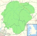
Dartmoor National Park map.svg 1,208 × 1,187; 469 KB
-
Dartmoor National Park UK location map.svg 1,208 × 1,187; 892 KB
-
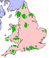
England and Wales NPs and AONBs map.svg 1,648 × 2,000; 1.79 MB
-
Exmoor National Park map.svg 1,425 × 1,040; 724 KB
-
Lake District National Park UK location map.svg 1,116 × 1,345; 1.6 MB
-
National Parks and AONBs in Northern England.svg 472 × 472; 1.26 MB
-
National Parks in England and Wales.png 377 × 447; 14 KB
-
National Parks in England and Wales.svg 990 × 1,181; 2.3 MB
-
New Forest National Park map.svg 1,244 × 1,227; 925 KB
-
New Forest National Park UK location map.svg 1,244 × 1,227; 1.18 MB
-
North York Moors National Park map.svg 1,425 × 1,200; 1.11 MB
-
North York Moors National Park UK location map.svg 1,425 × 1,200; 1.27 MB
-
Northumberland National Park map.svg 136 × 200; 985 KB
-
Northumberland National Park UK location map.svg 1,157 × 1,345; 896 KB
-
Peak District National Park map.svg 1,022 × 1,305; 1.2 MB
-
Peak District National Park UK location map.svg 1,022 × 1,305; 1.41 MB
-
South Downs National Park map.svg 1,425 × 884; 1.98 MB
-
South Downs National Park UK location map.svg 1,425 × 884; 2.03 MB
-
The Broads UK location map.svg 1,159 × 1,266; 1.55 MB
-
Yorkshire Dales National Park map 2016.svg 1,153 × 1,448; 1.08 MB
-
Yorkshire Dales National Park map.svg 1,157 × 1,345; 1.01 MB
-
Yorkshire Dales National Park UK location map.svg 1,088 × 1,346; 1.18 MB
-
Yorkshire Dales National Park.png 800 × 558; 379 KB
-
Yorkshire Dales NP map-pre-2016.svg 1,157 × 1,345; 1.14 MB


