Category:Maps of the Kingdom of Prussia
Jump to navigation
Jump to search
Subcategories
This category has the following 9 subcategories, out of 9 total.
M
S
Media in category "Maps of the Kingdom of Prussia"
The following 53 files are in this category, out of 53 total.
-
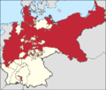
Map-deutsches-kaiserreich-preussen.png 1,280 × 1,087; 83 KB
-
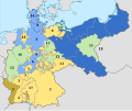
Map-DR-Prussia.svg 2,621 × 2,224; 712 KB
-
Kingdom of Prussia (1701–1918).svg 1,000 × 800; 704 KB
-
Growth prussia.gif 510 × 357; 14 KB
-
Map-DB-PrussiaProvs-1818.svg 1,798 × 1,576; 1.27 MB
-
Deutsches R Preussen.png 639 × 534; 22 KB
-
KRlandencijfers.png 1,280 × 1,087; 85 KB
-
Deutsches Reich (Karte) Preußen.svg 650 × 545; 1.04 MB
-
Map-Prussia.png 707 × 600; 137 KB
-
Uitbreiding Pruisen 1600-1795.png 510 × 357; 23 KB
-
Preussen-1806-es.svg 12,043 × 6,256; 2.23 MB
-
Ac.prussiamap3.png 716 × 425; 49 KB
-
Acprussiamap3-ko.png 716 × 425; 47 KB
-
Acprussiamap3.png 716 × 425; 49 KB
-
Brandenburg-Preussen-1701-1806 ohne Westen.png 1,020 × 831; 80 KB
-
Brandenburg-preussen-1701-1806.png 1,020 × 831; 245 KB
-
Expansion of Prussia3-es.svg 976 × 818; 881 KB
-
Ac.prussiamap3 Rus.png 1,080 × 641; 71 KB
-
Uitbreiding Pruisen 1807-1871.png 716 × 425; 30 KB
-
Karte polnischeteilungen4 neuostpreußen.png 290 × 250; 38 KB
-
Karte polnischeteilungen4.png 701 × 600; 595 KB
-
KRPruisen.png 1,200 × 1,015; 38 KB
-
Map of the Kingdom of Prussia in 1714.png 2,054 × 1,080; 249 KB
-
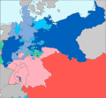
Map-AustroPrussianWar-annexed.svg 1,697 × 1,576; 755 KB
-
Map-AustroPrussianWar.svg 1,697 × 1,576; 790 KB
-
Neue Preußische Provinzen in Polen DE1.png 947 × 814; 39 KB
-
Neue Preußische Provinzen in Polen DE3.png 947 × 814; 37 KB
-
Neue Preußische Provinzen in Polen RU1.png 947 × 814; 40 KB
-
NeuSchlesien.png 286 × 226; 13 KB
-
Neue Preußische Provinzen in Polen DE2.png 947 × 814; 34 KB
-
Neue Preußische Provinzen in Polen RU2.png 947 × 814; 37 KB
-
Neue Preußische Provinzen in Polen RU3.png 947 × 814; 39 KB
-
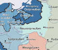
Neuostpreußen.png 288 × 250; 58 KB
-
Poles in German Empire, 1910 census.jpg 4,172 × 3,157; 6.23 MB
-
Pruisen Onder Frederik II.PNG 751 × 451; 35 KB
-
PruisenOnderFrederikII versie3.PNG 751 × 451; 36 KB
-
PruisenOnderFrederikII.PNG 752 × 451; 36 KB
-
PruisenOnderFrederikIIversie2-es.svg 12,043 × 6,256; 390 KB
-
PruisenOnderFrederikIIversie2.PNG 752 × 451; 36 KB
-
Prus1786Fr.gif 486 × 388; 18 KB
-
Prusia.PNG 955 × 591; 34 KB
-
Prusse1740.gif 760 × 464; 30 KB
-
Prusse1786.gif 760 × 464; 31 KB
-
Prusse1803.gif 760 × 464; 34 KB
-
Prussia 1806 map - DE.svg 712 × 547; 1.89 MB
-
Prussia 1806 map - RU.svg 712 × 547; 1.89 MB
-
Prussia3.gif 824 × 492; 20 KB
-
Preußische Provinz Südpreußen RUS.png 691 × 484; 34 KB
-
South Prussia 1795–1806 administrative map with departments, districts and all towns.jpg 3,000 × 2,225; 1.38 MB


