Category:Locator maps of the Kingdom of Prussia
Jump to navigation
Jump to search
Media in category "Locator maps of the Kingdom of Prussia"
The following 10 files are in this category, out of 10 total.
-
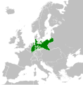
Kingdom of Prussia (1815).svg 450 × 456; 655 KB
-
Kingdom of Prussia 1714.svg 450 × 456; 893 KB
-
Kingdom of Prussia 1789.svg 450 × 456; 876 KB
-
Kingdom of Prussia 1797.svg 450 × 456; 852 KB
-
Kingdom of Prussia 1812.svg 450 × 456; 633 KB
-
Kingdom of Prussia 1815.svg 450 × 456; 734 KB
-
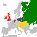
Map of the Holy Alliance (1840).svg 450 × 456; 807 KB
-
Map of the Quadruple Alliance (1815).svg 450 × 456; 709 KB
-
Map of the Quintuple Alliance (1818).svg 450 × 456; 709 KB
-
Kingdom of Prussia 1870.svg 450 × 456; 705 KB


