Category:Maps of the Iberian Peninsula in the 12th century
Jump to navigation
Jump to search
Iberian Peninsula (territory of present-day ![]() Spain and
Spain and ![]() Portugal) in 1101-1200 CE: Maps showing all or a substantial part of the Iberian Peninsula as it was in the 12th century.
Portugal) in 1101-1200 CE: Maps showing all or a substantial part of the Iberian Peninsula as it was in the 12th century.
Maps of the history of the Iberian Peninsula by century: (BCE) 5th century · 3rd century · 2nd century · 1st century · (CE) 1st century · 2nd century · 3rd century · 4th century · 5th century · 6th century · 7th century · 8th century · 9th century · 10th century · 11th century · 12th century · 13th century · 14th century · 15th century · 16th century · 17th century · 18th century · 19th century · 20th century · 21st century ·
Subcategories
This category has the following 2 subcategories, out of 2 total.
Media in category "Maps of the Iberian Peninsula in the 12th century"
The following 33 files are in this category, out of 33 total.
-
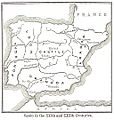
Modern history; Europe (1904) (14763413054).jpg 1,928 × 2,888; 1.74 MB
-
800px-Pennsula iberica 1150.png 800 × 555; 77 KB
-
España1150.jpg 830 × 640; 526 KB
-
España1150.svg 1,703 × 1,378; 2.59 MB
-
Pyreneiska halvön historisk.jpg 2,031 × 786; 670 KB
-
Spain in 1150 (William R. Shepherd).jpg 857 × 677; 305 KB
-
C. 1150 Iberian Peninsula.jpg 1,578 × 1,234; 1.52 MB
-
Al-Andalus, siglos XII-XIII.jpg 2,122 × 1,066; 646 KB
-
Mapa reconquista almohades-ru.svg 474 × 368; 43 KB
-
Mapa reconquista almohades.svg 474 × 368; 42 KB
-
Almohad map reconquest loc.jpg 474 × 401; 35 KB
-
Mapa reconquista almohades-en.svg 474 × 368; 42 KB
-
RebeliónDeIbnMardanis1160,svg.svg 2,268 × 1,396; 825 KB
-
Emirato Taifa Murcia.png 2,860 × 1,992; 652 KB
-
C. 1190 Iberian Peninsula.jpg 1,801 × 1,273; 1.73 MB
-
España 1190.jpg 500 × 468; 213 KB
-
Reconquista (914-1492).svg 845 × 750; 190 KB
-
Spruner-Menke Handatlas 1880 Karte 16.jpg 10,306 × 8,593; 22.62 MB
-
Europe-south-west-kingdoms12th.png 834 × 653; 440 KB
-
FERNANLD(1898) SPAIN in the 12th. & 13th. Cent..jpg 881 × 926; 416 KB
-
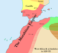
Map of the Murabitun (Almoravid) Empire in 1120.png 1,000 × 911; 77 KB
-
Mapa reconquiesta almuades.svg 474 × 368; 90 KB
-
Mapa reconquista almohades-pt.svg 474 × 368; 42 KB
-
NorthenIberia1126.jpg 1,836 × 1,379; 634 KB
-
Península Ibèrica 1100.png 800 × 555; 49 KB
-
Península Ibèrica 1103.png 800 × 555; 48 KB
-
Península ibérica 1150.svg 827 × 574; 1.28 MB
-
Péninsule ibérique en 1115.png 2,000 × 1,500; 1.1 MB
-
Péninsule ibérique en 1144.png 2,000 × 1,500; 990 KB
-
Péninsule ibérique en 1148.png 2,000 × 1,500; 1.03 MB
-
Péninsule ibérique en 1157.png 2,000 × 1,500; 1 MB
-
Péninsule ibérique en 1195.png 2,000 × 1,500; 948 KB
-
Péninsule ibérique es 1157.png 2,000 × 1,500; 1.08 MB


