Category:Maps of the Iberian Peninsula in the 9th century
Jump to navigation
Jump to search
Iberian Peninsula (territory of present-day ![]() Spain and
Spain and ![]() Portugal) in 801-900 CE: Maps showing all or a substantial part of the Iberian Peninsula as it was in the 9th century.
Portugal) in 801-900 CE: Maps showing all or a substantial part of the Iberian Peninsula as it was in the 9th century.
Maps of the history of the Iberian Peninsula by century: (BCE) 5th century · 3rd century · 2nd century · 1st century · (CE) 1st century · 2nd century · 3rd century · 4th century · 5th century · 6th century · 7th century · 8th century · 9th century · 10th century · 11th century · 12th century · 13th century · 14th century · 15th century · 16th century · 17th century · 18th century · 19th century · 20th century · 21st century ·
Subcategories
This category has only the following subcategory.
Media in category "Maps of the Iberian Peninsula in the 9th century"
The following 13 files are in this category, out of 13 total.
-
 Péninsule ibérique en 814.png 2,000 × 1,500; 867 KB
-
 Péninsule ibérique en 850.png 2,000 × 1,500; 826 KB
-
 Péninsule ibérique en 875.png 2,000 × 1,500; 859 KB
-
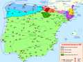
 Crisis del Emirato de Córdoba-pt.svg 694 × 539; 524 KB
-
 Crisis del Emirato de Córdoba.svg 694 × 539; 1,001 KB
-
 Comtats catalans s. VIII-XII (modificat).jpg 1,882 × 1,992; 656 KB
-
 Comtats catalans s. VIII-XII-es.svg 659 × 707; 439 KB
-
 Pyreneiska halvön historisk.jpg 2,031 × 786; 670 KB
-
 Crisis del Emirato de Córdoba-hu.svg 694 × 539; 671 KB
-
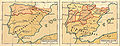
 Galicia891.png 624 × 335; 191 KB
-
 Péninsule ibérique en 900.png 2,000 × 1,500; 858 KB
-
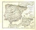 Spruner-Menke Handatlas 1880 Karte 15.jpg 3,599 × 2,995; 1.32 MB
-


.jpg)


.jpg)