Category:Maps of the Federation of Bosnia and Herzegovina
Jump to navigation
Jump to search
Wikimedia category | |||||
| Upload media | |||||
| Instance of | |||||
|---|---|---|---|---|---|
| Category combines topics | |||||
| Federation of Bosnia and Herzegovina | |||||
political entity within the sovereign country of Bosnia and Herzegovina | |||||
| Pronunciation audio | |||||
| Instance of | |||||
| Location | B&H | ||||
| Capital | |||||
| Official language | |||||
| Currency | |||||
| Head of state | |||||
| Head of government | |||||
| Inception |
| ||||
| Population |
| ||||
| Area |
| ||||
| Elevation above sea level |
| ||||
| Top-level Internet domain | |||||
| official website | |||||
 | |||||
Subcategories
This category has the following 3 subcategories, out of 3 total.
M
Pages in category "Maps of the Federation of Bosnia and Herzegovina"
This category contains only the following page.
Media in category "Maps of the Federation of Bosnia and Herzegovina"
The following 61 files are in this category, out of 61 total.
-
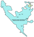
Alliance of Serb municipalities map 1.PNG 1,792 × 1,704; 112 KB
-
B-H entitásai opt hu.svg 1,471 × 1,392; 48 KB
-
Balkans2010.png 1,128 × 1,040; 135 KB
-
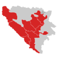
BH cantons & regions.png 3,215 × 3,057; 728 KB
-
BH municipality location 2 mk.svg 1,600 × 1,520; 269 KB
-
BH municipality location 2 sh.svg 1,600 × 1,520; 267 KB
-
BH municipality location 2.svg 1,600 × 1,520; 269 KB
-
BH municipality location.gif 1,600 × 1,520; 147 KB
-
BH municipality location.png 631 × 599; 54 KB
-
BiH blank with entities.png 500 × 500; 7 KB
-
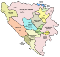
Bih cantons en.png 1,109 × 1,047; 96 KB
-
Bih cantons sh.png 1,109 × 1,047; 98 KB
-
Bih cantons sr.png 1,109 × 1,047; 97 KB
-
Bih outline map.png 1,068 × 1,074; 50 KB
-
Bosanska Posavina.png 400 × 180; 7 KB
-
Bosnia and Herzegovina districts blank.png 1,000 × 995; 10 KB
-
Bosnia and Herzegovina division 2005.png 2,416 × 3,036; 381 KB
-
Bosnia and Herzegovina location map-2.svg 1,063 × 1,014; 160 KB
-
Bosnia and Herzegovina location map.svg 1,063 × 1,014; 141 KB
-
Bosnia and Herzegovina Political without text.png 1,600 × 1,520; 131 KB
-
Bosnia and Herzegovina Political.png 1,600 × 1,520; 201 KB
-
Bosnia and Herzegovina subdivision map Cantons.png 1,600 × 1,520; 111 KB
-
Bosnia-Hertsegovinan federaatio.png 1,066 × 1,072; 133 KB
-
Bosnia-Herzegovina map modern.png 1,068 × 1,074; 64 KB
-
Bosniadivisions1.PNG 163 × 157; 4 KB
-
Bosniadivisions2.PNG 163 × 157; 4 KB
-
Bosniadivisions3.png 163 × 157; 6 KB
-
Bosnien-herzegowina 2-1225x1200.png 1,225 × 1,200; 371 KB
-
CantonsofBosnia.PNG 163 × 157; 5 KB
-
F bih02.png 943 × 1,010; 50 KB
-
Cities FBiH.png 592 × 592; 130 KB
-
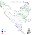
FBiH - etnički sastav stanovništva.PNG 819 × 781; 62 KB
-
FBiH alternativ.png 500 × 500; 7 KB
-
Fbih lokacija.PNG 1,594 × 1,194; 720 KB
-
FBIH outline.png 1,506 × 1,432; 45 KB
-
FBiH.png 500 × 500; 7 KB
-
FederacijaBiH.png 1,534 × 1,686; 123 KB
-
Federació de BiH.jpg 592 × 592; 43 KB
-
Federation BiH.png 1,000 × 995; 42 KB
-
LocationFédérationdeBosnieetHerzégovine.PNG 250 × 115; 6 KB
-
Federation of Bosnia and Herzegovina location map.jpg 2,144 × 2,046; 464 KB
-
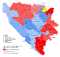
Federation Pres Election2010.PNG 631 × 599; 93 KB
-
Groups of the Second League of the Federation of Bosnia and Herzegovina.png 1,024 × 977; 186 KB
-
M bih03.jpg 700 × 615; 49 KB
-
Map Bih entities Belarusian.svg 1,471 × 1,392; 101 KB
-
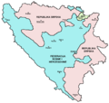
Map Bih entities.png 1,103 × 1,044; 67 KB
-
Map Bih entities lat.png 1,103 × 1,044; 66 KB
-
Map Bih entities cyr.png 1,103 × 1,044; 67 KB
-
Map Bih entities (ru).png 1,103 × 1,044; 67 KB
-
Map Bih entities mk.png 1,103 × 1,044; 74 KB
-
Map Bih entities-he.png 1,103 × 1,044; 53 KB
-
Bosnia herzegovina division 2.PNG 1,103 × 1,044; 67 KB
-
Bosnia herzegovina division 3.PNG 1,103 × 1,044; 73 KB
-
Map of the Federation of Bosnia and Herzegovina (with lines).png 509 × 490; 91 KB
-
Map of the Federation of Bosnia and Herzegovina (without lines).png 509 × 490; 64 KB
-
Municipalities and regions of Bosnia and Herzegovina.svg 1,600 × 1,520; 397 KB
-
Political devisions of Bosnia and Herzegovina.gif 1,600 × 1,520; 711 KB
-
Prepolovljene-opcine.gif 800 × 760; 102 KB
-
Босния и Герцеговина кантоны.png 922 × 894; 24 KB
-
Поділ Боснії і Герцеговини.png 682 × 599; 99 KB
-
보스니아 헤르체고비나의 행정구역 지도.png 1,103 × 1,044; 55 KB


