Category:Maps of cantons of the Federation of Bosnia and Herzegovina
Jump to navigation
Jump to search
Subcategories
This category has the following 2 subcategories, out of 2 total.
Media in category "Maps of cantons of the Federation of Bosnia and Herzegovina"
The following 32 files are in this category, out of 32 total.
-
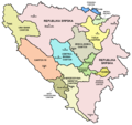
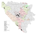
Bih cantons en.png 1,109 × 1,047; 96 KB
-
Bih cantons sh.png 1,109 × 1,047; 98 KB
-
Bih cantons sr.png 1,109 × 1,047; 97 KB
-
Bosnia and Herzegovina subdivision map Cantons.png 1,600 × 1,520; 111 KB
-
Canton 10 (Canton of Herceg-Bosna) Touristic Map.png 5,935 × 5,469; 1,008 KB
-
Canton 10.svg 2,000 × 1,811; 754 KB
-
Cantons of the Federation of Bosnia and Herzegovina mk.svg 1,063 × 1,014; 269 KB
-
Central Bosnia Bugojno.png 482 × 448; 13 KB
-
Central Bosnia Busovaca.png 482 × 448; 13 KB
-
Central Bosnia Donji Vakuf.png 482 × 448; 13 KB
-
Central Bosnia Fojnica.png 482 × 448; 13 KB
-
Central Bosnia Jajce.png 482 × 448; 5 KB
-
Central Bosnia Kiseljak.png 482 × 448; 13 KB
-
Central Bosnia Kresevo.png 482 × 448; 13 KB
-
Central Bosnia Novi Travnik.png 482 × 448; 13 KB
-
Central Bosnia Travnik.png 482 × 448; 13 KB
-
Central Bosnia Uskoplje.png 482 × 448; 13 KB
-
Central Bosnia Vitez.png 482 × 448; 13 KB
-
KantonSarajevoMunicipalities.png 202 × 219; 6 KB
-
Municipalities of Canton of Herceg-Bosna (Canton 10).png 5,935 × 5,469; 641 KB
-
Municipalities of the Federation of Bosnia and Herzegovina.svg 1,600 × 1,520; 399 KB
-
OpenStreetMap of Canton 10 (Herceg-Bosna).png 5,935 × 5,469; 9.15 MB
-
Sarajevo Ilijas.png 409 × 352; 8 KB
-
Sarajevo municipalities.PNG 409 × 352; 8 KB
-
Una-Sana Bihac.png 584 × 658; 10 KB
-
Una-Sana Bosanska Krupa.png 584 × 658; 20 KB
-
Una-Sana Bosanski Petrovac.png 584 × 658; 20 KB
-
Una-Sana Buzim.png 584 × 658; 20 KB
-
Una-Sana Cazin.png 584 × 658; 20 KB
-
Una-Sana Kljuc.png 584 × 658; 20 KB
-
Una-Sana Sanski Most.png 584 × 658; 20 KB
-
Una-Sana Velika Kladusa.png 584 × 658; 20 KB
