Category:Maps of the Eastern United States
Jump to navigation
Jump to search
Subcategories
This category has the following 3 subcategories, out of 3 total.
Media in category "Maps of the Eastern United States"
The following 76 files are in this category, out of 76 total.
-
US map-East Coast.svg 959 × 593; 90 KB
-
US map-East Coast.png 572 × 371; 15 KB
-
Map of the United States of America 1845.jpg 2,000 × 1,641; 3.02 MB
-
United States 1967 - eastern states.jpg 2,888 × 4,098; 2.82 MB
-
A history of the United States for schools (1899) (14779003632).jpg 1,444 × 2,330; 515 KB
-
Adirondacks-fr.jpg 405 × 313; 139 KB
-
Admiralty Chart No 2710 Delaware Bay to Florida Strait, published 1924, Large Corrections 1933.jpg 11,127 × 19,495; 54.63 MB
-
Appalachia Williams.png 444 × 474; 34 KB
-
Appalachian Highlands.jpg 1,547 × 872; 205 KB
-
Appalachian Ohio within Appalachia.png 570 × 585; 55 KB
-
AppalachianLocatorMap2.png 637 × 424; 84 KB
-
Appalachians and Appalachia Map TEST.jpg 429 × 737; 104 KB
-
NortheastAppalachiansMap.jpg 405 × 313; 185 KB
-
Basins and arches of the Atlantic Coastal Plain.png 404 × 549; 70 KB
-
Beaver wars map.jpg 871 × 736; 163 KB
-
BlankMap-USA-Northeast.svg 264 × 364; 34 KB
-
Brunswick in the USA.jpg 756 × 909; 202 KB
-
Carolinas.svg 959 × 593; 90 KB
-
Colonial Pipeline Disruption U.S. East Coast (29877529455).png 485 × 288; 111 KB
-
Colonial Pipeline System.png 1,260 × 884; 636 KB
-
Cumberlandplateaumap.png 600 × 600; 539 KB
-
Delaware and Chesapeake Bays satellite image.jpg 600 × 750; 218 KB
-
Delaware river watershed.png 600 × 836; 33 KB
-
Early indian east.jpg 1,664 × 2,000; 617 KB
-
East Region (WFTDA).png 1,513 × 983; 64 KB
-
Eastern agricultural complex.png 495 × 500; 901 KB
-
Eastern United States Map.jpg 1,242 × 1,550; 608 KB
-
Eastern US range map blank.png 540 × 638; 21 KB
-
FDIC Mid-Atlantic Region.jpg 322 × 374; 47 KB
-
Fifth Lighthouse District ppmsca.09354.jpg 2,387 × 3,035; 9.22 MB
-
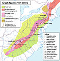
Greatvalley-map.jpg 624 × 637; 385 KB
-
Greatvalley-map.png 624 × 637; 66 KB
-
HollandAmerica.png 1,468 × 1,052; 34 KB
-
HollandinVSA.png 875 × 616; 39 KB
-
Indian history for young folks (1919) (14566585870).jpg 2,166 × 2,738; 935 KB
-
Indiana Bat Range FWS.jpg 349 × 392; 15 KB
-
Lenape Languages.png 1,182 × 1,387; 500 KB
-
Liquidambar styraciflua map.png 501 × 655; 100 KB
-
LLWS East.svg 959 × 593; 100 KB
-
LLWS Mid-Atlantic.svg 959 × 593; 94 KB
-
Magnolia grandiflora map.png 649 × 466; 74 KB
-
Map of territorial growth 1775.jpg 570 × 750; 172 KB
-
Map of the American East.jpg 2,931 × 3,501; 2.49 MB
-
Map of USA highlighting Eastern Seaboard.png 904 × 593; 26 KB
-
Maury Geography 051A Middle Atlantic.jpg 1,969 × 2,543; 1.06 MB
-
Middle Atlantic States.jpg 665 × 872; 407 KB
-
Native Tribes 1783.jpg 392 × 381; 35 KB
-
NortheastAppalachiansMap.gif 810 × 626; 76 KB
-
PAT - Eastern United States.gif 1,760 × 2,200; 1.01 MB
-
Potomac Highlands WVA.jpg 300 × 262; 30 KB
-
Ran clam NA range.gif 450 × 390; 12 KB
-
Skywave Effect of AM.png 1,537 × 1,184; 497 KB
-
Spatial distribution of VLM across the US Atlantic coast.webp 1,752 × 2,521; 680 KB
-
Symphyotrichum racemosum distribution.jpg 1,024 × 1,024; 306 KB
-
The Mid-Atlantic States.png 1,513 × 983; 43 KB
-
US Atlantic States.svg 1,181 × 731; 2.23 MB
-
US east coast middle appalachian physio map.jpg 343 × 474; 72 KB
-
US East Temples Outline Map.svg 364 × 542; 39 KB
-
USA oral vaccination.jpg 404 × 449; 36 KB
-
USDA Hardiness zone map detail for northeast US.jpg 313 × 250; 48 KB


