Category:Maps of the Blue Nile
Jump to navigation
Jump to search
Media in category "Maps of the Blue Nile"
The following 30 files are in this category, out of 30 total.
-
 Description de l'univers (1683) (14804154853).jpg 2,202 × 3,140; 1.24 MB
-
 Emap1683.jpg 1,326 × 1,800; 662 KB
-
 Map of the source of the Nile, 1683.jpg 725 × 1,078; 171 KB
-

-
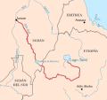
 Abbay OSM.png 596 × 638; 688 KB
-
 BlauerNil.jpg 567 × 479; 41 KB
-
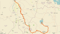 Blue Nile after lake Tana.png 975 × 559; 422 KB
-
 Blue nile map-HE-2.jpg 567 × 479; 143 KB
-
 Blue nile map-HE.png 567 × 479; 131 KB
-
 Blue nile map.png 567 × 479; 130 KB
-
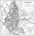 Ethiopia1911.png 2,004 × 2,066; 3.06 MB
-
 Fazughli and the Blue Nile.jpg 1,500 × 1,542; 1.28 MB
-
 Lower Aber river and tributaries.png 923 × 891; 1.04 MB
-
 Modrý Nil.jpg 540 × 538; 73 KB
-
 Nile blue white.PNG 174 × 256; 89 KB
-
 Nile ya buluu.png 567 × 479; 133 KB
-
 Niloazul.jpg 567 × 479; 100 KB
-
 NiloAzul.svg 630 × 593; 311 KB
-
 Niloblanco.jpg 460 × 709; 78 KB
-
 Renaissance Dam site.jpg 496 × 683; 396 KB
-
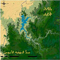 Renaissance Reservoir-ar.jpg 563 × 563; 74 KB
-
 Renaissance Reservoir.jpg 563 × 563; 57 KB
-
 Sinine Niilus.png 567 × 479; 128 KB
-
 White and Blue Nile-de.svg 438 × 572; 424 KB
-
 White and Blue Nile-en.svg 438 × 572; 472 KB
-
 White and Blue Nile-es.svg 445 × 585; 522 KB
-
 White and Blue Nile-fi.svg 365 × 480; 776 KB
-
 White and Blue Nile-he.svg 438 × 572; 415 KB
-
 White and Blue Nile-mk.svg 438 × 572; 376 KB
-
 White Nile and Blue Nile-ja.svg 365 × 480; 743 KB
_(14804154853).jpg)


_-_Geographicus_-_Nil-mallet-1719.jpg)


