Category:Maps of the Aleutian Islands
Jump to navigation
Jump to search
Media in category "Maps of the Aleutian Islands"
The following 77 files are in this category, out of 77 total.
-

-
-
-
 1924 map of American fliers route from Alaska to Japan.png 2,928 × 1,033; 101 KB
-
 Adak be.svg 1,000 × 960; 223 KB
-
 Admiralty Chart No 2460 Kamchatka to Kodiak Island, Published 1884, New Edition 1917.jpg 10,900 × 13,831; 45.18 MB
-
 Admiralty Chart No 2460 Kamchatka to San Francisco, Published 1942, Large Corrections 1960.jpg 17,721 × 11,259; 53.78 MB
-
 Agattu Island.png 2,062 × 1,360; 875 KB
-
 Alaska and the Aleutians Map.jpg 1,059 × 732; 124 KB
-
 Alaska and the Aleutians.jpg 5,020 × 2,775; 1.44 MB
-
 Alaska.PNG 602 × 362; 58 KB
-
 Aleuten Lage-blank.png 707 × 545; 703 KB
-
 Aleuten Lage-he.png 884 × 681; 867 KB
-
 Aleuten Lage.png 707 × 545; 631 KB
-
 Aleutian arc physical geography.png 1,457 × 1,277; 1.95 MB
-
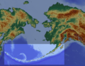
 Aleutian Islands map - 2.png 640 × 456; 101 KB
-
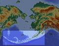
 Aleutian Islands map nationalatlas.jpg 1,676 × 660; 782 KB
-
 Aleutian Islands Reservation EO 1733 illustration.jpg 3,210 × 2,252; 475 KB
-
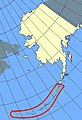
 Aleutian Islands, outlined in red.png 610 × 383; 298 KB
-
 Aleutian Islands.PNG 747 × 470; 310 KB
-
 AleutianIslands.jpeg 650 × 182; 30 KB
-
 Aleutians.jpg 407 × 595; 197 KB
-
 Aleuty.png 514 × 315; 15 KB
-
 Aleuudide-idaosa.png 1,708 × 666; 515 KB
-
 Amak Island EO 5318 illustration.png 2,916 × 3,689; 97 KB
-
 Amaknak Island EO 5243 illustration.png 2,849 × 3,823; 461 KB
-
 Amchitka Island Map.jpg 794 × 564; 113 KB
-
 AmchitkaTestSites he.svg 693 × 469; 28 KB
-
 AmchitkaTestSites-es.svg 693 × 469; 28 KB
-
 AmchitkaTestSites.svg 693 × 469; 28 KB
-
 Andreanof Map Delarof.jpg 560 × 249; 60 KB
-
 Andreanof Map.jpg 560 × 249; 24 KB
-

-
 AttuIslandWW2.png 520 × 308; 57 KB
-
 Avo map 46.png 767 × 500; 168 KB
-
 Bering Sea Aleutian Is Alaska map.png 1,457 × 1,277; 2.04 MB
-
 Beringmeer-Aleuten-Karte.png 1,457 × 1,281; 2.04 MB
-
 Blueak.png 250 × 155; 7 KB
-
 BobrofMap.png 1,141 × 1,281; 152 KB
-
 Cooper Islands.svg 274 × 376; 390 KB
-
 EB9 Aleutian Islands.jpg 1,619 × 560; 270 KB
-
 EQuakes-aleutian-beachballl-2014.pdf 1,845 × 1,454; 1.19 MB
-

-
 Fox Islands.jpg 538 × 213; 20 KB
-
 Foxi-saarte-kaart.png 1,861 × 657; 508 KB
-

-

-
 Karte Aleuten-Vulkanbogen.png 1,457 × 1,281; 1.95 MB
-
 Kasatochi Island map.jpg 1,263 × 875; 298 KB
-
 Kiska Island.png 8,640 × 8,640; 21.46 MB
-
 KiskaMap.jpg 1,000 × 900; 248 KB
-
 KoniujiMap.png 791 × 693; 53 KB
-
 Littlesitkin.png 561 × 568; 55 KB
-
 M 7.9 - 19km SE of Little Sitkin Island, Alaska - intensity.jpg 612 × 719; 52 KB
-
 Map amutka.gif 500 × 414; 104 KB
-
 Map of alaska volcanoes bogoslof.jpg 640 × 456; 226 KB
-
 Map of alaska volcanoes carlisle.jpg 640 × 456; 226 KB
-
 Map of alaska volcanoes gilbert.jpg 640 × 456; 225 KB
-

-
 Mapa Hipsometryczna-Aleuty i Rów Aleucki.png 2,610 × 1,441; 508 KB
-
 Near Islands.jpg 363 × 197; 39 KB
-
 NizkiMap.png 1,600 × 1,118; 720 KB
-
 North-Pacific-air-routes.png 500 × 441; 34 KB
-
 Operational Navigation Chart E-11, 4th edition.jpg 9,254 × 6,772; 8.08 MB
-
 Operational Navigation Chart E-12, 3rd edition.jpg 9,254 × 6,728; 7.61 MB
-
 Operational Navigation Chart E-13, 2nd edition.jpg 9,254 × 6,792; 6.99 MB
-
 PacificTheaterAug1942.jpg 1,199 × 873; 256 KB
-
 Rat Islands II.jpg 435 × 197; 14 KB
-

-
 Rigobert-Bonne-Atlas-de-toutes-les-parties-connues-du-globe-terrestre MG 0007.tif 5,196 × 3,522; 52.39 MB
-
 SemisopochnoiMap.png 1,286 × 1,021; 554 KB
-
 SemisopochnoiNauticalChart.png 1,112 × 987; 156 KB
-
 TanagaMap.png 781 × 600; 356 KB
-
 The American Museum journal (c1900-(1918)) (17537803104).jpg 2,864 × 1,132; 535 KB
-
 Txu-pclmaps-topo-us-attu-1970.jpg 5,951 × 4,572; 2.92 MB
-
 Western Aleutians.png 826 × 478; 10 KB
-
 Карта Восточного океана, 1851.jpg 3,328 × 2,000; 441 KB


_(20156926900).jpg)


_entitled_%22An_act_to_protect_the_seal_fisheries_of_Alaska,_and_for_other_purposes_(1910)_(14597636957).jpg)
.jpg)


_(14577807837).jpg)


%27_(11063826264).jpg)
%27_(16590198315).jpg)
)_(17537803104).jpg)