Category:Maps of Alaska volcanoes
Jump to navigation
Jump to search
Subcategories
This category has the following 26 subcategories, out of 26 total.
*
- Maps of the Aleutian Islands (77 F)
A
- Maps of Augustine Island (3 F)
B
C
D
- Maps of Mount Dutton (2 F)
F
- Maps of Fourpeaked volcano (3 F)
G
I
- Maps of Mount Iliamna (4 F)
K
- Maps of Mount Kaguyak (1 F)
- Maps of Mount Katmai (3 F)
M
- Maps of Mount Mageik (4 F)
N
- Maps of Novarupta (5 F)
R
T
- Maps of Trident volcano (5 F)
U
- Maps of the Ukinrek Maars (2 F)
W
Media in category "Maps of Alaska volcanoes"
The following 12 files are in this category, out of 12 total.
-
 Andreanof Map.jpg 560 × 249; 24 KB
-
 BobrofMap.png 1,141 × 1,281; 152 KB
-
 Fourpeaked-map1.jpg 800 × 701; 82 KB
-
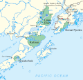
 Kodiak-Bowie Seamounts.jpg 600 × 365; 57 KB
-
 Map augustine.gif 874 × 776; 23 KB
-
 Map of Alaska Peninsula Volcanoes.gif 398 × 288; 38 KB
-
 Map of Alaska Volcanoes 1.gif 375 × 395; 117 KB
-
 Map of alaska volcanoes bogoslof.jpg 640 × 456; 226 KB
-
 Map of alaska volcanoes yantarni.jpg 640 × 456; 226 KB
-
 Map of four Alaskan National Parks.gif 450 × 436; 20 KB
-
 Northern Cordilleran Volcanic Province map.jpg 544 × 613; 139 KB
-
 TanagaMap.png 781 × 600; 356 KB


