Category:Maps of subdivisions of Denmark
Jump to navigation
Jump to search
Subcategories
This category has the following 5 subcategories, out of 5 total.
Media in category "Maps of subdivisions of Denmark"
The following 21 files are in this category, out of 21 total.
-
Danish-counties-1662-1793.png 400 × 466; 12 KB
-
Danmarks administrative inddeling 1945.png 2,683 × 2,157; 1.47 MB
-
Danske herreder.jpg 1,600 × 1,166; 498 KB
-
Danske-amter-1793-1970.png 400 × 479; 11 KB
-
Dena si,ore-2.svg 465 × 550; 383 KB
-
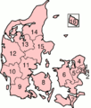
Denmark AdmDivision.png 399 × 474; 16 KB
-
Denmark administrative 1945.png 2,683 × 2,157; 1.48 MB
-
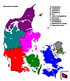
Denmark colour.png 465 × 550; 15 KB
-
Denmark numbered by old ISO-3166-2-01.png 430 × 479; 40 KB
-
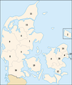
DenmarkNumbered.png 400 × 469; 15 KB
-
DK for localizations+placenames.png 1,650 × 1,650; 155 KB
-
DK Provinces.JPG 723 × 838; 77 KB
-
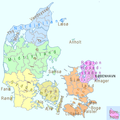
DK Regions and Provinces.JPG 837 × 838; 89 KB
-
DK Sjælland kommuner.png 1,170 × 1,458; 86 KB
-
DK survey.png 1,650 × 1,650; 178 KB
-
DK Syddanmarks kommuner.png 1,591 × 1,255; 125 KB
-
DR-distrikter.png 845 × 1,000; 215 KB
-
Map DK Regions2.png 465 × 550; 46 KB
-
Region Sønderjylland-Schleswig forvaltningskort2.jpg 1,798 × 1,807; 293 KB
-
Regioni della danimarca 2007.png 490 × 599; 341 KB
-
Regions of Denmark.jpg 481 × 550; 57 KB


