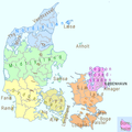
Category:Administrative maps of Denmark
Jump to navigation
Jump to search
Subcategories
This category has the following 3 subcategories, out of 3 total.
+
Media in category "Administrative maps of Denmark"
The following 7 files are in this category, out of 7 total.
-
Administrative division of denmark in medieval times.jpg 5,952 × 4,336; 15.8 MB
-
Danmark med bilande - Map of Denmark 19th century.jpg 7,510 × 7,509; 9.64 MB
-
Danmarks administrative inddeling 1945.png 2,683 × 2,157; 1.47 MB
-
Denmark administrative 1945.png 2,683 × 2,157; 1.48 MB
-
Denmark Input Administrative Boundaries (5457755676).jpg 2,524 × 3,209; 777 KB
-
DK survey.png 1,650 × 1,650; 178 KB
-
Jutland Denmark 1871 map.jpg 4,112 × 5,132; 6.64 MB


