Category:Maps of national parks of Canada
Jump to navigation
Jump to search
Subcategories
This category has the following 5 subcategories, out of 5 total.
Media in category "Maps of national parks of Canada"
The following 26 files are in this category, out of 26 total.
-
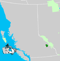
Canadian National Parks Location.png 976 × 790; 112 KB
-
Canadian National Parks.png 2,750 × 2,300; 989 KB
-
Bwca map.png 1,000 × 781; 311 KB
-
Canadian Rocky Mountain parks map hu.svg 408 × 424; 176 KB
-
Canadian Rocky Moutain parks map es.svg 408 × 424; 176 KB
-
Canadian Rocky Moutain parks map He.svg 408 × 424; 248 KB
-
Canadian Rocky Moutain parks map hr.svg 408 × 424; 176 KB
-
Canadian Rocky Moutain parks map-fr.svg 408 × 424; 176 KB
-
Canadian Rocky Moutain parks map.svg 408 × 424; 176 KB
-
Carte Parc des Glaciers.svg 527 × 537; 1.26 MB
-
Glacier National Park (Canada) Location.png 559 × 568; 84 KB
-
Jasper National Park Location.png 328 × 537; 17 KB
-
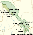
Jasper national park.png 604 × 634; 15 KB
-
Jasper national park.svg 658 × 710; 76 KB
-
Kananaskis park system.png 773 × 793; 58 KB
-
Kootenay National Park Location.png 658 × 552; 93 KB
-
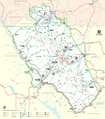
Map of Glacier National Park.jpg 1,657 × 1,885; 1.96 MB
-
Map of Glacier National Park.PNG 1,657 × 1,885; 2.44 MB
-
Map of Glacier National Park.png 3,250 × 3,406; 5.04 MB
-
Mount Revelstoke National Park Location.png 533 × 633; 38 KB
-
NP-Natural-Regions-EN-11x17-04Feb2020-High-Res-FINAL-DIR.jpg 5,100 × 3,300; 6.23 MB
-
Quttinirpaaq National Park map-fr.png 1,800 × 1,310; 712 KB
-
Quttinirpaaq National Park map-fr.svg 1,800 × 1,310; 839 KB
-
Quttinirpaaq National Park map-ru.svg 1,800 × 1,310; 852 KB
-
Waterton Lakes National Park Location.png 318 × 511; 14 KB
-
Yoho National Park Location.png 670 × 540; 93 KB


