Category:Maps of islands of Russia
Jump to navigation
Jump to search
Subcategories
This category has the following 12 subcategories, out of 12 total.
!
- SVG maps of islands of Russia (23 F)
*
F
H
- Maps of Hogland (9 F)
K
M
N
- Maps of Nordenskiöld Archipelago (14 F)
S
Media in category "Maps of islands of Russia"
The following 75 files are in this category, out of 75 total.
-
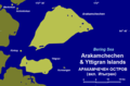 Arakamchechen1w.png 889 × 583; 66 KB
-
 Chkalov1w rus.png 1,152 × 894; 62 KB
-
 Chkalov1w.png 1,152 × 894; 51 KB
-
 Color map of Routan Islands, East Siberian Sea, Russia.png 811 × 579; 27 KB
-
 De longi saared.png 2,546 × 1,997; 322 KB
-
 Delong.PNG 609 × 478; 49 KB
-
 Delong1.PNG 609 × 478; 16 KB
-
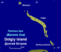 Dolgiy.PNG 574 × 494; 17 KB
-
 Dolgiy2y.PNG 574 × 494; 18 KB
-
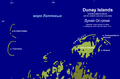 Dunay1a RU.png 1,623 × 1,063; 201 KB
-
 Dunay1a.png 1,623 × 1,063; 228 KB
-
 Faddey2y.PNG 560 × 425; 15 KB
-
 Firnley2 rus.png 470 × 575; 24 KB
-
 Firnley2.PNG 470 × 575; 16 KB
-
 Gejberg.PNG 542 × 389; 13 KB
-
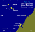 Gejberg9.png 609 × 561; 30 KB
-
 IleSimushir.png 4,320 × 4,320; 15.15 MB
-
 Imperatritsy Yevgenii.png 1,880 × 1,880; 132 KB
-
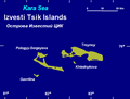 Izvestyytsik.PNG 605 × 460; 15 KB
-
 Kirov.PNG 710 × 514; 18 KB
-
 Kirov1q.PNG 643 × 511; 19 KB
-
 Kolguyev-txu-oclc-6654394-nr-39-40-3rd-ed.png 1,307 × 1,469; 3.18 MB
-
 Kolomeitsev.PNG 617 × 433; 14 KB
-
 Kolosovykh.PNG 1,176 × 750; 40 KB
-
 Kolosovykh5.PNG 1,176 × 750; 25 KB
-
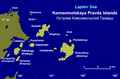
 Komsomolskoy.PNG 774 × 516; 25 KB
-
 Komsomolskoy3y.PNG 790 × 517; 30 KB
-
 Kuril islands Yankicha.png 517 × 473; 4 KB
-
 Kuril islands.png 517 × 473; 4 KB
-
 Maly Vysotsky Island.png 450 × 502; 22 KB
-
 Map of Bennett Island 1902.jpg 507 × 395; 74 KB
-
 Map of Moneron Island.png 1,000 × 500; 38 KB
-
 Middendorff2b.PNG 743 × 496; 31 KB
-
 Mona1q.PNG 590 × 409; 14 KB
-
 Mona1w.PNG 590 × 409; 14 KB
-
 Morzhovets2x.png 948 × 666; 100 KB
-
 New Siberian Islands Afrikaans.png 1,500 × 1,219; 357 KB
-
 New Siberian Islands map Bennett island.PNG 1,500 × 1,219; 517 KB
-
 New Siberian Islands map.png 1,500 × 1,219; 514 KB
-
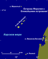
 Nordenshelda.PNG 1,717 × 1,707; 235 KB
-
 Nordenshelda2w.PNG 1,742 × 1,854; 151 KB
-
 Nordenshelda2x.PNG 1,742 × 1,854; 150 KB
-
 Nordenshelda3g.PNG 854 × 908; 55 KB
-
 Nordenskiöld Archipelago map-en.svg 843 × 898; 305 KB
-
 Nordenskiöld Archipelago map-fr.svg 843 × 898; 305 KB
-
 Ostrov victoria.PNG 621 × 471; 12 KB
-
 Ostrova sv petra RU.PNG 863 × 671; 78 KB
-
 Ostrova sv petra.PNG 863 × 671; 68 KB
-
 Ostrova sv petra2.PNG 863 × 671; 71 KB
-
 Peschanyy laptev.PNG 418 × 328; 53 KB
-
 Plavnikovyye ок.png 1,227 × 855; 94 KB
-
 Plavnikovyye.PNG 1,227 × 855; 55 KB
-
 Plavnikovyye5y.PNG 1,227 × 855; 57 KB
-
 Pyasinskiy zaliv5.PNG 1,184 × 768; 49 KB
-
 Rimskogo-Korsakova archipelago.png 1,880 × 1,880; 143 KB
-
 Russkyy.PNG 815 × 599; 46 KB
-
 Scott-gansen.PNG 484 × 371; 11 KB
-
 Sergeikirov.PNG 681 × 515; 18 KB
-
 Shantar1z rus.png 1,288 × 913; 82 KB
-
 Shantar1z.png 1,288 × 913; 45 KB
-
 Sibiryakov1z.png 763 × 712; 38 KB
-
 Spafariev1w.png 811 × 653; 35 KB
-
 Stolbovoy.PNG 741 × 516; 16 KB
-
 Svordrup.PNG 456 × 402; 11 KB
-
 Taymyra.PNG 1,157 × 812; 61 KB
-
 Taymyra2y.PNG 1,157 × 812; 71 KB
-
 Tillo 2.PNG 547 × 364; 22 KB
-
 Uedineniya.PNG 543 × 375; 13 KB
-
 Ukatny karta.png 541 × 442; 19 KB
-
 Uurasmap.jpg 580 × 1,252; 186 KB
-
 Vize1.PNG 532 × 477; 12 KB
-
 Voronina.PNG 456 × 397; 9 KB
-
 Yana bay1.png 901 × 644; 51 KB
-
 Карта Симушира.png 4,320 × 4,320; 14.8 MB
-
 新知島の地図.png 4,320 × 4,320; 15.08 MB


