Category:Maps of Franz Joseph Land
Jump to navigation
Jump to search
Wikimedia category | |||||
| Upload media | |||||
| Instance of | |||||
|---|---|---|---|---|---|
| Category combines topics | |||||
| Franz Josef Land | |||||
archipelago in the Arctic | |||||
| Instance of | |||||
| Named after | |||||
| Location | Arkhangelsk Oblast, Russia | ||||
| Located in or next to body of water | |||||
| Discoverer or inventor | |||||
| Has part(s) |
| ||||
| Time of discovery or invention |
| ||||
| Population |
| ||||
| Area |
| ||||
| Elevation above sea level |
| ||||
 | |||||
Subcategories
This category has only the following subcategory.
Media in category "Maps of Franz Joseph Land"
The following 88 files are in this category, out of 88 total.
-
Admiralty Chart No 2282 Arctic Ocean and Greenland Sea, Published 1872.jpg 15,062 × 12,375; 19.49 MB
-
Blank Franz Joseph Land.svg 850 × 400; 159 KB
-
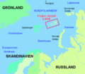
EPNZ 1-3 oil and gas areas.png 743 × 653; 237 KB
-
Frans Josefland Ligging.gif 442 × 386; 10 KB
-
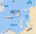
Franz Josef Land location-de.svg 507 × 470; 58 KB
-
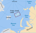
Franz Josef Land location-en.svg 507 × 470; 57 KB
-
Franz Josef Land location-es.svg 507 × 470; 61 KB
-
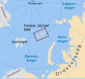
Franz Josef Land location-hu.svg 507 × 470; 68 KB
-
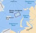
Franz Josef Land location-mk.svg 507 × 470; 105 KB
-
Franz Josef Land location-ru.svg 507 × 470; 58 KB
-
Franz Josef Land location-zh.svg 507 × 470; 58 KB
-
Franz Joseph Land map de.png 995 × 448; 28 KB
-
Franz Josephi maa.svg 1,289 × 862; 720 KB
-
Franz Jozefand-Eilanden-Duits.gif 995 × 448; 20 KB
-
Franz-Joseph-Land Uebersicht.GIF 442 × 386; 9 KB
-
Franzjosef.PNG 248 × 225; 24 KB
-
FranzJosefLand1.gif 350 × 306; 119 KB
-
FranzJosefLand2.gif 820 × 369; 336 KB
-
Jackson map.jpg 619 × 416; 112 KB
-
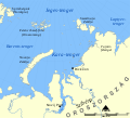
Kara Sea map hr.svg 1,004 × 915; 296 KB
-
Kara Sea map hu.svg 1,256 × 1,144; 349 KB
-
Kara Sea map RU.png 952 × 868; 323 KB
-
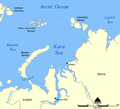
Kara Sea map.png 942 × 858; 258 KB
-
Kara sea ZFJ.PNG 710 × 534; 18 KB
-
Kara sea ZFJAL.PNG 710 × 534; 18 KB
-
Kara sea ZFJBZ.PNG 710 × 534; 18 KB
-
Kara sea ZFJCH.PNG 710 × 534; 18 KB
-
Kara sea ZFJGB.PNG 710 × 534; 18 KB
-
Kara sea ZFJHA.PNG 710 × 534; 18 KB
-
Kara sea ZFJHK.PNG 710 × 534; 18 KB
-
Kara sea ZFJHS.PNG 710 × 534; 18 KB
-
Kara sea ZFJJC.PNG 710 × 534; 18 KB
-
Kara sea ZFJKA.PNG 710 × 534; 18 KB
-
Kara sea ZFJMK.PNG 710 × 534; 18 KB
-
Kara sea ZFJNB.PNG 710 × 534; 18 KB
-
Kara sea ZFJNN.PNG 710 × 534; 18 KB
-
Kara sea ZFJPG.PNG 710 × 534; 18 KB
-
Kara sea ZFJSB.PNG 710 × 534; 18 KB
-
Kara sea ZFJSM.PNG 710 × 534; 18 KB
-
Kara sea ZFJWI.png 710 × 534; 18 KB
-
Kara sea ZFJWL.PNG 710 × 534; 18 KB
-
Kara sea ZFJWN.PNG 710 × 534; 18 KB
-
Kara sea ZFJZL.PNG 710 × 534; 18 KB
-
Kartenskizze Kaiser-Franz-Josef-Fjord.jpg 1,027 × 625; 190 KB
-
Leigh Smith 1880 expedition map.tif 4,275 × 3,657; 15.04 MB
-
Map of central Franz Josef Land-en.svg 362 × 523; 346 KB
-
Map of Franz Josef Land-de.svg 1,289 × 862; 719 KB
-
Map of Franz Josef Land-en.svg 1,289 × 862; 719 KB
-
Map of Franz Josef Land-es.svg 1,289 × 862; 726 KB
-
Map of Franz Josef Land-hu.svg 1,289 × 862; 779 KB
-
Map of Franz Josef Land-mk.svg 1,289 × 862; 1.8 MB
-
Map of Franz Josef Land-ru.svg 1,289 × 862; 709 KB
-
Map of Franz Joseph Land Jackson 1897.jpg 1,353 × 986; 558 KB
-
Map of Graham Bell Island and Wilczek Land-en.svg 451 × 565; 103 KB
-
Map of Southeastern Franz Josef Land-en.svg 513 × 397; 344 KB
-
Map of Western Franz Josef Land-en.svg 429 × 472; 323 KB
-
Map of Western Franz Josef Land-mk.svg 429 × 472; 340 KB
-
Nansen and Johansen route 1895-96 IMG 0414.jpg 3,612 × 2,629; 1.72 MB
-
Nansen and Johansen route 1895-96 IMG 0415.jpg 3,703 × 2,694; 1.9 MB
-
Nansen Franz Josef Land Trip Base Map.PNG 1,017 × 683; 100 KB
-
Nansen Franz Josef Land voyage map-de.svg 600 × 438; 239 KB
-
Nansen Franz Josef Land voyage map-fr.svg 599 × 437; 200 KB
-
Nansen Franz Josef Land voyage map-no.png 600 × 438; 77 KB
-
Nansen Franz Josef Land Voyage Map.PNG 1,017 × 683; 118 KB
-
Nansen Franz Josef Land voyage map.svg 600 × 438; 400 KB
-
Nansen Franz Josef Land.jpg 1,019 × 823; 397 KB
-
NU-38-39-40-41.jpg 4,724 × 2,653; 2.17 MB
-
Operational Navigation Chart A-2, 2nd edition.jpg 9,254 × 6,659; 13.7 MB
-
Operational Navigation Chart B-2, 3rd edition.jpg 9,254 × 6,716; 13.42 MB
-
Orthographic projection centered over Nagurskoye, Russia.png 488 × 487; 21 KB
-
Outline Map of Franz Josef Land.svg 360 × 256; 618 KB
-
Payer Karte Franz Josef Land 1874.jpg 613 × 821; 155 KB
-
Payer map Franz Josef Land 1874.jpg 1,397 × 1,844; 413 KB
-
Petermann Franz-Josef-Land, provisorische Karte 1874.png 738 × 984; 1.23 MB
-
Petermann Franz-Josef-Land, provisorische Skizze 1874.png 1,176 × 966; 2.11 MB
-
Porter Map of Franz Josef Land Ziegler Expedition.png 2,172 × 2,896; 8.76 MB
-
Relief Map of Franz Josef Land.png 600 × 427; 403 KB
-
The Quarterly journal of the Geological Society of London (12893767163).jpg 2,032 × 1,248; 566 KB
-
Térkép 1874-43.JPG 1,673 × 1,661; 300 KB
-
Yenisey gub - section - Franz Josef Land.jpg 759 × 439; 190 KB
-
Zemlja Franje Josipa.png 310 × 185; 23 KB
-
Франца Иосифа Земля.jpg 3,024 × 2,296; 3.82 MB

