Category:Maps of infectious diseases of Europe
Jump to navigation
Jump to search
Temperate regions: North America · South America · Africa · Europe · Asia · Oceania – Polar regions: – Other regions:
Subcategories
This category has the following 3 subcategories, out of 3 total.
2
B
- Bubonic plague maps (11 F)
Media in category "Maps of infectious diseases of Europe"
The following 44 files are in this category, out of 44 total.
-
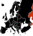
A(H1N1) 2009 epidemic chronology Europe.png 2,458 × 2,048; 482 KB
-
B.melitensis in Europe.png 1,200 × 1,001; 97 KB
-
B.melitensis in Europe.svg 595 × 599; 408 KB
-
Black death.jpg 772 × 520; 212 KB
-
Bubonic plague map - empty version.png 1,024 × 1,108; 437 KB
-
Bubonic plague map 2.png 1,000 × 1,048; 159 KB
-
Bubonic plague map gr.png 1,000 × 1,048; 172 KB
-
Bubonic plague map-ar.png 1,024 × 1,108; 506 KB
-
Bubonic plague map.PNG 1,024 × 1,108; 481 KB
-
Bubonic plague-be.svg 696 × 790; 272 KB
-
Bubonic plague-en.svg 696 × 790; 590 KB
-
Bubonic plague-es.svg 696 × 790; 589 KB
-
Bubonic plague-he.svg 696 × 790; 731 KB
-
Bubonic plague-hu.svg 696 × 790; 591 KB
-
Bubonic plague-it.svg 696 × 790; 583 KB
-
Bubonic plague-ka.svg 696 × 790; 591 KB
-
Bubonic plague-ru.svg 696 × 790; 266 KB
-
Bubonic plague-ua.svg 656 × 741; 472 KB
-
Bubonic plague-uk.svg 696 × 790; 606 KB
-
Die Ehe Tuberculoser und ihre Folgen (1894) (14757370146).jpg 3,040 × 2,510; 1.45 MB
-
Diffusion de la peste noire en europe 1347-1351.png 1,280 × 1,387; 134 KB
-
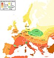
E. coli 2011 Map.svg 680 × 540; 328 KB
-
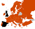
EARS-Net CAESAR MRSA 2017-en.svg 533 × 465; 117 KB
-
EARS-Net MRSA 2012.svg 528 × 462; 207 KB
-
EARSS MRSA 2008-en.svg 533 × 465; 117 KB
-
EARSS MRSA 2008.svg 533 × 465; 117 KB
-
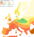
Echinococcus multilocularis in Europe in foxes 2014.svg 2,560 × 1,892; 636 KB
-
H1N1 Europe Community Outbreaks.svg 645 × 690; 529 KB
-
H1N1 Europe Map by confirmed cases.svg 645 × 690; 324 KB
-
H1N1 Europe Map by confirmed deaths.svg 645 × 690; 325 KB
-
H1N1 Europe Map.svg 645 × 690; 324 KB
-
Izurri beltzaren hedapena Europan.png 1,280 × 1,387; 403 KB
-
Pestilence spreading 1347-1351 europe pl.png 1,280 × 1,387; 376 KB
-
Pestilence spreading 1347-1351 europe-ca.svg 1,280 × 1,387; 808 KB
-
Pestilence spreading 1347-1351 europe.png 1,280 × 1,387; 350 KB
-
Pestilence spreading 1347-1351 europeHUN.png 1,280 × 1,387; 305 KB
-
Pestilence spreading Japane.png 1,280 × 1,387; 105 KB
-
Pesto-1347-1351-Eŭropo-eo.jpg 1,280 × 1,387; 538 KB
-
Rabies oral vaccination.jpg 634 × 497; 45 KB
-
Schmallenberg distribution map.png 680 × 520; 185 KB
-
Spread of Swine Flu in Europe.svg 645 × 690; 617 KB
-
Svartedauden Europa 1347-1351.png 1,280 × 1,387; 422 KB
-
Swine flu Europe map.png 2,458 × 2,048; 413 KB


