Category:Maps of infectious diseases of Africa
Jump to navigation
Jump to search
Temperate regions: North America · South America · Africa · Europe · Asia · Oceania – Polar regions: – Other regions:
Subcategories
This category has the following 2 subcategories, out of 2 total.
Media in category "Maps of infectious diseases of Africa"
The following 24 files are in this category, out of 24 total.
-
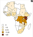
2009 Africa epidemic.png 357 × 221; 9 KB
-
Africa Community Outbreaks.svg 1,000 × 1,000; 193 KB
-
African map indicating.png 327 × 367; 76 KB
-
African meningitis belt - 2016.JPG 584 × 597; 43 KB
-
African meningitis belt - 2016.png 757 × 785; 68 KB
-
Ceinture africaine de la méningite de Lapeyssonnie.jpg 1,147 × 1,047; 247 KB
-
Dot Density.png 641 × 731; 327 KB
-
Ebola Hemorrhagic Fever Distribution Map.jpg 485 × 543; 96 KB
-
Ebolafälle bis einschließlich 2020 english.png 692 × 867; 159 KB
-
Ebolafälle bis einschließlich 2020.png 692 × 867; 169 KB
-
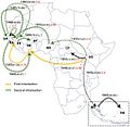
EbolaSubmit2.png 3,000 × 2,251; 122 KB
-
Gelbfieber in Afrika 2010 CDC.svg 512 × 515; 148 KB
-
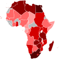
H1N1 Africa Map by confirmed cases.svg 1,000 × 1,000; 205 KB
-
H1N1 Africa Map by confirmed deaths.svg 1,000 × 1,000; 205 KB
-
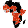
H1N1 Africa Map.svg 1,000 × 1,000; 205 KB
-
Lassa fever Outbreak Distribution Map.svg 500 × 340; 326 KB
-
Lassa-distribution-map.jpg 800 × 1,035; 95 KB
-
Meningococcal Meningitis Range.svg 1,000 × 1,000; 180 KB
-
Parasite130072-fig1 Map of cutaneous leishmaniasis in North Africa.tif 2,343 × 808; 313 KB
-
Trypanosomiasis map-2015.png 2,000 × 2,000; 241 KB
-
Yellow fever Africa 2005.png 532 × 562; 63 KB
-
Yellow fever Africa 2009.jpeg 1,280 × 854; 135 KB


