Category:Maps of former subdivisions of Lincolnshire
Jump to navigation
Jump to search
Media in category "Maps of former subdivisions of Lincolnshire"
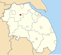
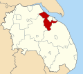
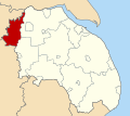
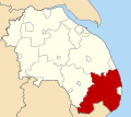
The following 21 files are in this category, out of 21 total.
-
Alford Urban District, Lindsey (1970).svg 686 × 612; 149 KB
-
Barton upon Humber Urban District, Parts of Lindsey (1970).svg 686 × 612; 149 KB
-
Brigg Urban District, Lindsey (1970).svg 686 × 612; 149 KB
-
Caistor Rural District, Lindsey (1970).svg 686 × 612; 149 KB
-
Gainsborough Rural District, Lindsey (1970).svg 686 × 612; 149 KB
-
Gainsborough Urban District, Lindsey (1970).svg 686 × 612; 149 KB
-
Glanford Brigg Rural District, Lindsey (1970).svg 686 × 612; 149 KB
-
Grimsby Rural District, Lindsey (1970).svg 686 × 612; 149 KB
-
Horncastle Rural District, Lindsey (1970).svg 686 × 612; 149 KB
-
Horncastle Urban District, Lindsey (1970).svg 686 × 612; 149 KB
-
Isle of Axholme Rural District, Lindsey (1970).svg 686 × 612; 149 KB
-
Louth Rural District, Lindsey (1970).svg 686 × 612; 149 KB
-
Mablethorpe and Sutton Urban District, Lindsey (1970).svg 686 × 612; 149 KB
-
Market Rasen Urban District, Lindsey (1970).svg 686 × 612; 149 KB
-
Municipal Borough of Cleethorpes, Lindsey (1970).svg 686 × 612; 149 KB
-
Municipal Borough of Louth, Lindsey (1970).svg 686 × 612; 149 KB
-
Municipal Borough of Scunthorpe, Lindsey (1970).svg 686 × 612; 149 KB
-
Skegness Urban District, Lindsey (1970).svg 686 × 612; 149 KB
-
Spilsby Rural District, Lindsey (1970).svg 686 × 612; 149 KB
-
Welton Rural District, Lindsey (1970).svg 686 × 612; 149 KB
-
Woodhall Spa Urban District, Lindsey (1970).svg 686 × 612; 149 KB


