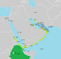
Category:Maps of former colonies of Portugal in Asia
Jump to navigation
Jump to search
Subcategories
This category has the following 3 subcategories, out of 3 total.
Media in category "Maps of former colonies of Portugal in Asia"
The following 32 files are in this category, out of 32 total.
-
Bangladesh PV.png 800 × 1,087; 852 KB
-
Dutch and Portuguese in Asia c 1665.png 617 × 473; 30 KB
-
Kolonialmächte im Pazifikraum, 1939.svg 1,039 × 814; 1.76 MB
-
Mar Vermelho 29.png 1,200 × 1,961; 2.71 MB
-
Pacific Area - Imperial Powers 1939 - Map.svg 1,039 × 814; 4.44 MB
-
Pacific Area - The Imperial Powers 1939 - Map mk.svg 1,039 × 814; 4.43 MB
-
Pacific Area - The Imperial Powers 1939 - Map-es.svg 1,039 × 814; 2.89 MB
-
Pacific Area - The Imperial Powers 1939 - Map-hu.svg 1,039 × 814; 4.47 MB
-
Pacific Area - The Imperial Powers 1939 - Map-it.svg 1,039 × 814; 2.25 MB
-
Pacific Area - The Imperial Powers 1939 - Map-zh.svg 1,039 × 814; 4.44 MB
-
Pacific Area - The Imperial Powers 1939 - Map.svg 1,039 × 814; 4.49 MB
-
Persian Gulf PT1.png 900 × 494; 646 KB
-
Persian Gulf Pt7.png 900 × 494; 710 KB
-
Persian Gulf Pt8.png 900 × 494; 654 KB
-
Port-KlSunda.png 243 × 220; 12 KB
-
Port-Molukken.png 504 × 560; 18 KB
-
Portuguese Arabia V17.png 1,378 × 1,035; 152 KB
-
Portuguese Arabia V18.png 1,023 × 993; 143 KB
-
Portuguese Arabia V20.png 800 × 777; 166 KB
-
Portuguese Empire V30.png 800 × 777; 212 KB
-
Portuguese Empire V31.png 800 × 777; 176 KB
-
Portuguese Empire V33.png 800 × 777; 177 KB
-
Portuguese Empire V35.png 800 × 777; 180 KB
-
Portuguese Empire V36-ar.png 1,023 × 993; 139 KB
-
Portuguese Empire V36.png 1,023 × 993; 157 KB
-
Portuguese in Thailand V01.png 474 × 898; 156 KB
-
Portuguese in Thailand Vx.png 474 × 898; 165 KB
-
Portuguese in Thailand.png 474 × 898; 173 KB
-
Tamao Map Full Hong Kong.png 4,126 × 3,000; 490 KB
-
Yemen Pt06-ar.jpg 1,693 × 1,106; 563 KB
-
Yemen Pt06.jpg 1,693 × 1,106; 448 KB
-
Yemen Pt08.jpg 1,693 × 1,106; 441 KB


