Category:Maps of Portuguese India
Jump to navigation
Jump to search
| NO WIKIDATA ID FOUND! Search for Maps of Portuguese India on Wikidata | |
| Upload media |
Use the appropriate category for maps showing all or a large part of India. See subcategories for smaller areas:
| If the map shows | Category to use |
|---|---|
| India on a recently created map | Category:Maps of India or its subcategories |
| India on a map created more than 70 years ago | Category:Old maps of India or its subcategories |
| the history of India on a recently created map | Category:Maps of the history of India or its subcategories |
| the history of India on a map created more than 70 years ago | Category:Old maps of the history of India or its subcategories |
Use the appropriate category for maps showing all or a large part of Portugal. See subcategories for smaller areas:
| If the map shows | Category to use |
|---|---|
| Portugal on a recently created map | Category:Maps of Portugal or its subcategories |
| Portugal on a map created more than 70 years ago | Category:Old maps of Portugal or its subcategories |
| the history of Portugal on a recently created map | Category:Maps of the history of Portugal or its subcategories |
| the history of Portugal on a map created more than 70 years ago | Category:Old maps of the history of Portugal or its subcategories |
Media in category "Maps of Portuguese India"
The following 32 files are in this category, out of 32 total.
-
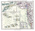
ATLAS JUSTUS PERTHES 14.jpg 4,349 × 3,845; 12.34 MB
-
Bangladesh PV20.png 800 × 1,087; 812 KB
-
Carreira da India de.svg 1,054 × 654; 848 KB
-
Carreira da India es.svg 1,054 × 654; 604 KB
-
Daman, Dadra, Nagar Haveli stamp - 1957.jpg 527 × 692; 118 KB
-
Divar (Ilha de Piedade), India Portuguesa.png 1,169 × 574; 1.8 MB
-
EstadoInd.jpg 329 × 575; 53 KB
-
European settlements in India 1501-1739.png 1,140 × 700; 168 KB
-
Historical map of India AD 1531-ar.jpg 927 × 611; 135 KB
-
Kerala cities at time of Cabral (1500).gif 307 × 415; 17 KB
-
Map India Portuguesa.png 350 × 425; 72 KB
-
Map of Portuguese Carreira da India.gif 1,047 × 593; 69 KB
-
Map of Portuguese India .png 1,709 × 1,404; 514 KB
-
Map of Portuguese India.png 1,709 × 1,404; 482 KB
-
Map Portugual insular e imperio 800x600.jpg 800 × 725; 133 KB
-
Map-of-the-Portuguese-settlements-in-India.-Author-Hugo Refachinho V03 Gujarate.png 1,709 × 1,404; 514 KB
-
Plan de la ville de Cochin (Cochim) Paris 1761.jpg 6,536 × 4,700; 2.42 MB
-
Portuguese Empire V31.png 800 × 777; 176 KB
-
Portuguese Goa 1620 - Manuel Godinho de Herédia.png 1,337 × 1,014; 2.92 MB
-
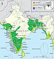
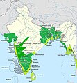
Portuguese India 16-17th centuries v04.gif 1,525 × 1,440; 345 KB
-
Portuguese India 16-17th centuries v05.jpg 837 × 902; 339 KB
-
Portuguese India 16-17th centuries.png 836 × 900; 370 KB
-
Portuguese India.png 328 × 323; 39 KB
-
Portuguese India.PNG 438 × 531; 74 KB
-
Portuguese Southeast Asia Ax.jpg 836 × 900; 191 KB
-
Portuguese Southeast Asia Axty.png 836 × 900; 332 KB
-
Portuguese Southeast Asia AxtyV12.png 836 × 900; 372 KB
-
Spruner-Menke Handatlas 1880 Karte 20.jpg 10,433 × 8,737; 16.46 MB


