Category:Maps of districts in the Czech Republic
Jump to navigation
Jump to search
Subcategories
This category has the following 78 subcategories, out of 78 total.
B
C
D
F
H
J
K
L
M
N
O
P
R
S
T
U
V
Z
Ú
Č
Š
Ž
Media in category "Maps of districts in the Czech Republic"
The following 37 files are in this category, out of 37 total.
-
3republika.png 1,255 × 634; 63 KB
-
Beroun poloha.png 1,156 × 612; 51 KB
-
CR Districts 1993-1995.png 615 × 355; 16 KB
-
CR Districts 1996-2004.png 615 × 355; 17 KB
-
CR Districts 2005-2006.png 615 × 355; 17 KB
-
CR Districts 2007-2011.png 615 × 355; 17 KB
-
CR MAP RC.png 1,826 × 1,380; 501 KB
-
CR-okresy-general-Model.svg 512 × 384; 1 MB
-
Czech Republic districts 2007 blank.png 619 × 356; 21 KB
-
Czech Republic districts.png 1,300 × 878; 42 KB
-
Districts of Czech Republic vector line model.svg 1,021 × 587; 231 KB
-
Gemeinden Tschechien 2020.png 2,500 × 1,572; 2.27 MB
-
Gouldovska mentalni mapa.png 1,680 × 1,050; 386 KB
-
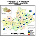
Kartodiagrm.jpg 753 × 757; 259 KB
-
Kriminalita2011.PNG 1,053 × 624; 70 KB
-
Map of counties of the Czech Republic by RUIAN, 2020-09-12.svg 512 × 293; 15.66 MB
-
Mapa 2013.png 619 × 356; 19 KB
-
Okres Beroun.png 1,616 × 1,300; 191 KB
-
Okresni hejtmanstvi 1900.PNG 1,411 × 823; 72 KB
-
Okresy - slepá mapa.png 3,845 × 2,222; 939 KB
-
Okresy 1938.png 1,224 × 719; 69 KB
-
Okresy CR mirne generalizovane.svg 512 × 293; 169 KB
-
Okresy ČR 2007.PNG 1,053 × 624; 20 KB
-
Okresy.png 1,053 × 624; 49 KB
-
Percentage of photos of municipalities in the Czech Republic.png 619 × 356; 17 KB
-
Percentage of photos of protected areas in the Czech Republic.png 619 × 356; 18 KB
-
Semafor of COVID-19 disease at 2020-09-04 at Czech Republic.svg 512 × 293; 170 KB
-
StareOkresy.PNG 1,279 × 775; 65 KB
-
Treti republika zeme dle okresu.png 1,255 × 634; 72 KB
-
WikiProject Protected areas - good articles.png 619 × 356; 28 KB
-
České okresy 1950.png 1,339 × 787; 47 KB
-
České okresy 1960.png 1,053 × 624; 20 KB
-
Čáslavský kraj r. 1654 v dnešním okrese Chrudim.jpg 5,400 × 5,080; 4.41 MB


