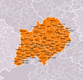
Category:Maps of Beroun District
Jump to navigation
Jump to search
Wikimedia category | |||||
| Upload media | |||||
| Instance of | |||||
|---|---|---|---|---|---|
| Category combines topics | |||||
| Beroun District | |||||
District in the Central Bohemian Region of the Czech Republic | |||||
| Instance of | |||||
| Named after | |||||
| Location |
| ||||
| Capital | |||||
| Population |
| ||||
| Area |
| ||||
 | |||||
Subcategories
This category has the following 9 subcategories, out of 9 total.
K
- Maps of Karlštejn (2 F)
L
M
- Maps of Chyňava (1 F)
- Maps of Hořovice (4 F)
- Maps of Liteň (1 F)
- Maps of Otmíče (1 F)
N
- Maps of Nižbor (2 F)
Media in category "Maps of Beroun District"
The following 21 files are in this category, out of 21 total.
-
Map CZ - district Beroun.PNG 1,281 × 878; 37 KB
-
068 Srbsko konec ulice Ke Kodě informace.jpg 5,184 × 3,456; 5.32 MB
-
168 U konce lesa od Kody informace.jpg 3,456 × 5,184; 6.81 MB
-
240 U lom Malá Amerika informace.jpg 5,184 × 3,456; 5.76 MB
-
346 Nižbor u křižovatky mapa.jpg 5,184 × 3,456; 9.53 MB
-
Anoldka-informacni tabule-02-2019-vysoky ujezd.jpg 4,000 × 6,000; 15.72 MB
-
Beroun District 2008 names BE CZ.png 976 × 936; 104 KB
-
Beroun Limite communale.jpg 952 × 577; 182 KB
-
Beroun poloha.png 1,156 × 612; 51 KB
-
Beroun přehled.jpg 1,200 × 680; 146 KB
-
Charte vom Berauner Kreise des Königreichs Böheim.jpg 6,267 × 4,755; 8.37 MB
-
Lety, Sokolská, mapa cyklotras.jpg 3,264 × 2,448; 1.27 MB
-
Lom Malá Amerika, schema.jpg 2,448 × 3,264; 1,022 KB
-
Lomy Amerika, schema západní části.jpg 3,264 × 2,448; 2.15 MB
-
Mapa jeskyne arnika.jpg 510 × 1,137; 181 KB
-
Okres Beroun WPF 0909.png 1,680 × 1,312; 282 KB
-
Okres Beroun WPF.png 1,680 × 1,312; 268 KB
-
Okres beroun.png 619 × 356; 19 KB
-
Okres Beroun.png 1,616 × 1,300; 191 KB
-
Schéma hromadné dopravy Karlštejnsko.jpg 2,448 × 3,264; 1.34 MB
-
SPR Karlštejn - Koda, tabule.jpg 3,264 × 2,448; 2.49 MB


