Category:Maps of departments of France
Jump to navigation
Jump to search
Departments of Metropolitan France: Ain [01] · Aisne [02] · Allier [03] · Alpes-de-Haute-Provence [04] · Hautes-Alpes [05] · Alpes-Maritimes [06] · Ardèche [07] · Ardennes [08] · Ariège [09] · Aube [10] · Aude [11] · Aveyron [12] · Bouches-du-Rhône [13] · Calvados [14] · Cantal [15] · Charente [16] · Charente-Maritime [17] · Cher [18] · Corrèze [19] · Corse-du-Sud [2A]† · Haute-Corse [2B]† · Côte-d’Or [21] · Côtes-d'Armor [22] · Creuse [23] · Dordogne [24] · Doubs [25] · Drôme [26] · Eure [27] · Eure-et-Loir [28] · Finistère [29] · Gard [30] · Haute-Garonne [31] · Gers [32] · Gironde [33] · Hérault [34] · Ille-et-Vilaine [35] · Indre [36] · Indre-et-Loire [37] · Isère [38] · Jura [39] · Landes [40] · Loir-et-Cher [41] · Loire [42] · Haute-Loire [43] · Loire-Atlantique [44] · Loiret [45] · Lot [46] · Lot-et-Garonne [47] · Lozère [48] · Maine-et-Loire [49] · Manche [50] · Marne [51] · Haute-Marne [52] · Mayenne [53] · Meurthe-et-Moselle [54] · Meuse [55] · Morbihan [56] · Moselle [57] · Nièvre [58] · Nord [59] · Oise [60] · Orne [61] · Pas-de-Calais [62] · Puy-de-Dôme [63] · Pyrénées-Atlantiques [64] · Hautes-Pyrénées [65] · Pyrénées-Orientales [66] · Bas-Rhin [67] · Haut-Rhin [68] · departmental district of the Rhône [69] · Rhône [69D]‡ · Metropolis of Lyon [69M]‡ · Haute-Saône [70] · Saône-et-Loire [71] · Sarthe [72] · Savoie [73] · Haute-Savoie [74] · Paris [75] · Seine-Maritime [76] · Seine-et-Marne [77] · Yvelines [78] · Deux-Sèvres [79] · Somme [80] · Tarn [81] · Tarn-et-Garonne [82] · Var [83] · Vaucluse [84] · Vendée [85] · Vienne [86] · Haute-Vienne [87] · Vosges [88] · Yonne [89] · Territoire de Belfort [90] · Essonne [91] · Hauts-de-Seine [92] · Seine-Saint-Denis [93] · Val-de-Marne [94] · Val-d'Oise [95]
Overseas departments and regions: Guadeloupe [971] · Martinique [972] · French Guiana [973] · Réunion [974] · Mayotte [976]
Overseas collectivities: Saint Pierre and Miquelon [975] · Saint Barthélemy [977] · Saint-Martin [978] · Wallis and Futuna [986] · French Polynesia [987] · French Southern and Antarctic Lands [984]+
Sui generis territories: New Caledonia [988] · Clipperton Island [989]+
Use the appropriate category for maps showing all or a large part of departments of France. See subcategories for smaller areas:
| If the map shows | Category to use |
|---|---|
| departments of France on a recently created map | Category:Maps of departments of France or its subcategories |
| departments of France on a map created more than 70 years ago | Category:Old maps of departments of France or its subcategories |
| the history of departments of France on a recently created map | Category:Maps of the history of departments of France or its subcategories |
| the history of departments of France on a map created more than 70 years ago | Category:Old maps of the history of departments of France or its subcategories |

Subcategories
This category has the following 8 subcategories, out of 8 total.
!
'
*
Media in category "Maps of departments of France"
The following 35 files are in this category, out of 35 total.
-
 1789 + 2022 Auvergne-Rhône-Alpes, noms.png 1,416 × 1,209; 206 KB
-
 1789 + 2022 Bourgogne-Franche-Comté, noms.png 1,451 × 1,290; 222 KB
-
 1789 + 2022 Bretagne, noms.png 1,135 × 873; 101 KB
-
 1789 + 2022 France, noms des régions.png 4,264 × 4,098; 1.34 MB
-
 1789 + 2022 Grand Est, noms.png 1,583 × 1,125; 210 KB
-
 1789 + 2022 Hauts-de-France + Île, noms.png 866 × 1,378; 136 KB
-
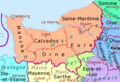 1789 + 2022 Normandie, noms.png 1,228 × 836; 117 KB
-
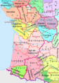 1789 + 2022 Nouvelle Aquitaine, noms.png 1,361 × 1,895; 277 KB
-
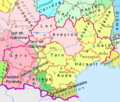 1789 + 2022 Occitanie, noms.png 1,483 × 1,260; 204 KB
-
 1789 + 2022 Pays de la Loire, noms.png 1,130 × 1,134; 150 KB
-
 1789 + 2022 Provence, noms.png 984 × 914; 100 KB
-
 1789 + 2022 Île-de-France216.png 2,025 × 1,554; 595 KB
-
 1789 et 2022, Centre-Val de Loire et Île-de-France, noms.png 1,200 × 1,368; 188 KB
-
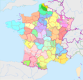
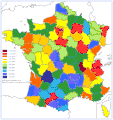
 2022 France - régions et départements, noms hu.png 1,842 × 1,696; 1.11 MB
-
 2022 France - régions et départements, noms.png 1,842 × 1,696; 619 KB
-
 Altitudes maximales.PNG 632 × 600; 117 KB
-
 Associations contact france.jpg 500 × 368; 105 KB
-
 CarteMEL.jpg 414 × 462; 47 KB
-
 Enseignement en France 1.PNG 526 × 556; 42 KB
-
 France 1789 + 2022.png 4,264 × 4,098; 1.26 MB
-
 France, same-sex marriages by departments.png 3,000 × 2,649; 1.02 MB
-
 FrancePiB par habitants departemetns.gif 1,140 × 1,210; 129 KB
-
 ONEMlogo.jpg 177 × 177; 9 KB
-
 Reduktion der Gemeinden in Frankreich pro Département 2016.png 3,000 × 2,649; 1.1 MB
-
 Reduktion der Gemeinden in Frankreich pro Département 2017.png 4,000 × 3,532; 1.57 MB
-
 Reduktion der Gemeinden in Frankreich pro Département 2018.png 4,000 × 3,532; 1.46 MB
-
 Reduktion der Gemeinden in Frankreich pro Département 2019.png 3,000 × 2,649; 1.09 MB
-
 Reduktion der Gemeinden in Frankreich pro Département 2020.png 3,000 × 2,649; 975 KB
-
 Reduktion der Gemeinden in Frankreich pro Département 2021.png 3,000 × 2,649; 975 KB
-
 Reduktion der Gemeinden in Frankreich pro Département 2022.png 3,000 × 2,649; 988 KB
-
 Reduktion der Gemeinden in Frankreich pro Département 2023.png 3,000 × 2,649; 991 KB
-
 Reduktion der Gemeinden in Frankreich pro Département 2024.png 4,000 × 3,532; 1.43 MB
-
 Reduktion der Gemeinden in Frankreich pro Département 2025.png 4,000 × 3,532; 1.55 MB
-
 Repartition vespa velutina.jpg 550 × 600; 69 KB
-
 Répartition vespa velutina 2013.png 544 × 551; 37 KB


